
Download trail navigation apps with voice guidance features before your next park visit—AllTrails and Komoot offer turn-by-turn audio directions that work offline, ensuring you never miss a pathway marker or accessible route entrance. These tools transform smartphones into personal outdoor guides that speak directions aloud, eliminating the need to constantly check your screen on uneven terrain.
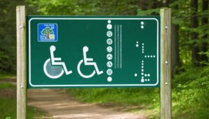
Check Parks Canada’s AccessToGo database and Ontario Parks’ accessibility filters to identify trails with firm, stable surfaces, gradual grades, and rest areas positioned at regular intervals. Many parks now provide detailed accessibility ratings beyond basic wheelchair symbols, including surface texture descriptions, width measurements, and gradient percentages that help you match trails to your specific mobility needs.
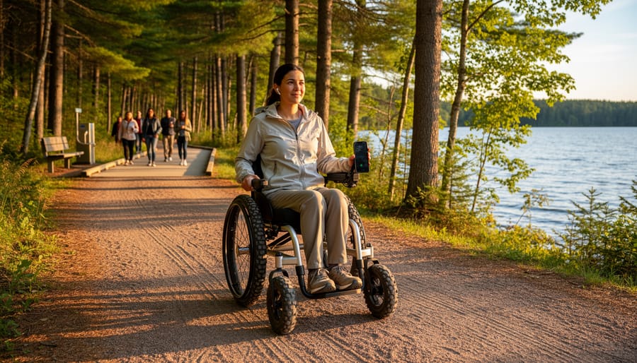
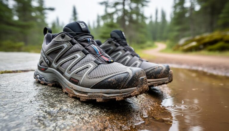
Request mobility equipment from park visitor centers at destinations like Algonquin Park and Bruce Peninsula National Park, where trail wheelchairs with large all-terrain tires are available for day use at no cost. These specialized chairs navigate packed gravel, boardwalks, and forest paths that standard wheelchairs cannot handle, opening up wilderness experiences previously considered off-limits.
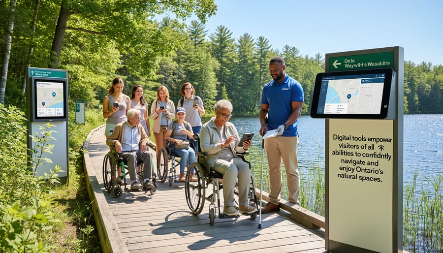
Join guided accessible outdoor programs through conservation authorities and adaptive recreation groups that provide trained staff, specialized equipment, and small group settings designed for various ability levels. These organized outings remove the guesswork from trip planning while connecting you with others who understand that accessibility outdoors isn’t about limitations—it’s about using the right digital tools and resources to experience Ontario’s natural spaces on your own terms.
Why Accessibility Outdoors Matters More Than You Think
Picture Sarah, a grandmother from Thunder Bay who uses a wheelchair, watching her grandkids explore a forest trail while she waited in the parking lot. She’d been an avid hiker before her accident, and missing these moments felt like losing a piece of herself. This story isn’t unique. In Ontario, over 2.9 million people live with some form of disability, and that number includes seniors, individuals with mobility challenges, visual or hearing impairments, and invisible disabilities too.
Here’s what really matters: nature isn’t a luxury. It’s medicine. Studies show time outdoors reduces stress, lowers blood pressure, and boosts mood for everyone, regardless of ability. When we design trails and parks that only work for some people, we’re essentially saying certain folks don’t deserve these benefits. That’s not just unfair; it’s a missed opportunity for our communities.
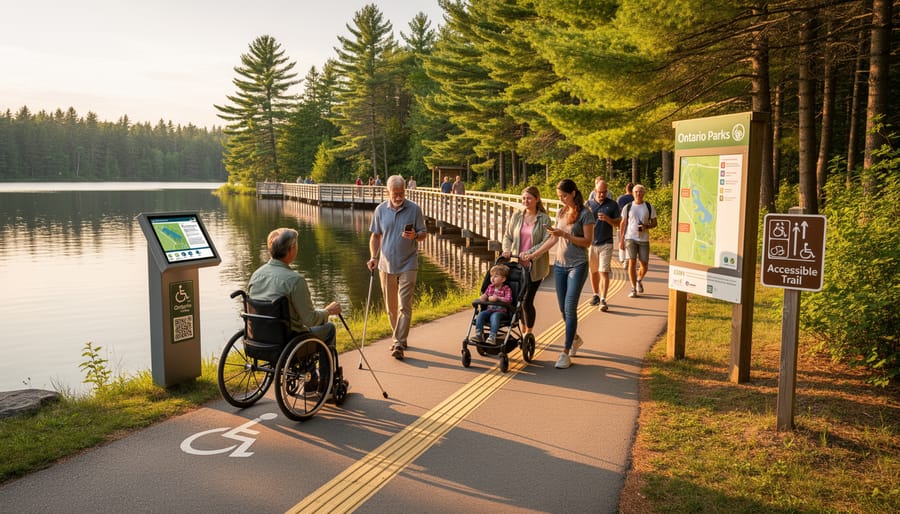
The good news? Ontario is making progress toward accessible outdoor experiences. More parks now feature paved paths, beach wheelchairs, accessible washrooms, and sensory-friendly spaces. These improvements don’t just help people with disabilities. Parents with strollers, folks recovering from injuries, and older adults benefit too.
When Sarah finally discovered an accessible boardwalk trail near her cottage, everything changed. She could lead her grandkids on nature walks again, pointing out birds and wildflowers from her chair. That’s the power of inclusive design. It brings families together and reminds us that everyone deserves to feel the sun on their face and breathe in that pine-scented air.
Creating welcoming outdoor spaces isn’t about checking boxes. It’s about recognizing that nature belongs to all of us.
The Digital Revolution in Park Accessibility
Planning Your Visit from Home
Before you pack your bags, take advantage of the wealth of online resources that help you plan an accessible outdoor adventure from your couch. Many Ontario parks now offer detailed accessibility information on their websites, including downloadable PDF guides that outline everything from parking spaces to trail gradients. I always recommend checking these out first—they’ve saved me from more than a few unexpected surprises!
Virtual tours have become game-changers for trip planning. Some parks feature 360-degree photos of facilities, letting you virtually walk through visitor centers, washrooms, and picnic areas before arriving. These tours help you familiarize yourself with the layout and identify potential barriers ahead of time.
Look for websites that provide specific measurements: doorway widths, ramp slopes, accessible parking distances from trailheads, and campsite features like level tent pads or accessible fire pits. Insider tip: call the park office directly with questions—staff members often know details that aren’t listed online and can suggest the most suitable trails for your needs.
Many conservation areas also maintain up-to-date trail condition reports online. Check these before heading out, especially after storms, as accessibility features can be temporarily affected. Planning ahead means more time enjoying nature and less time problem-solving on arrival.
Real-Time Information at Your Fingertips
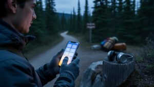
Getting real-time updates while you’re out on the trails has become remarkably easier, thanks to smart technology solutions designed with accessibility in mind. Many Ontario parks now offer mobile apps that provide GPS-enabled navigation, showing you exactly where accessible paths, washrooms, and rest areas are located in relation to your current position.
I recently watched a visitor with a mobility aid use the AccessNow app to report a temporary obstruction on an accessible trail, and within hours, other users could see the alert and plan accordingly. That’s the power of crowd-sourced information working in real time.
Apps like AllTrails and TrailLink now include accessibility filters, letting you search specifically for wheelchair-friendly routes or trails with gentle grades. You can check current trail conditions, recent reviews from other visitors with accessibility needs, and even see photos of specific features before you arrive.
Insider tip: Download your maps and trail information before leaving home, since cell service can be spotty in remote parks. Many apps offer offline functionality, ensuring you won’t lose navigation capabilities even without a signal. Some parks also provide Bluetooth beacon systems that send location-specific information directly to your smartphone, creating an interactive experience that adapts to your exact position along the trail.
Essential Digital Accessibility Tools for Ontario Parks
Ontario Parks Website Accessibility Features
Planning your Ontario Parks adventure has never been easier, thanks to some seriously helpful website features designed with everyone in mind. The Ontario Parks website includes accessibility filters that let you search for campsites and facilities based on your specific needs—no more scrolling through endless options wondering if a particular site will work for you.
Here’s an insider tip: when you’re browsing campsites, look for the detailed facility information sections. These aren’t just generic descriptions—they include specifics like the width of pathways, whether surfaces are paved or gravel, and exact measurements of door openings. You’ll find visual descriptions of terrain too, which help you picture what you’re getting into before you arrive. Is that trail gently sloping or does it have steep sections? The website tells you upfront.
The platform works seamlessly with screen readers, making navigation smooth for visitors who rely on assistive technology. I’ve heard from friends who use screen readers that they appreciate how logically the information is organized—it actually makes sense rather than jumping around randomly.
One eco-friendly suggestion: bookmark the parks you’re interested in and review their accessibility details during off-peak hours to reduce server load. The search filters save your preferences, so you won’t need to re-enter your requirements each time. This means less frustration and more time actually planning the fun parts of your trip—like deciding which trails to explore or which lakeside spot will be perfect for your morning coffee.
Mobile Apps That Make the Difference
The right app can transform how you experience Ontario’s outdoors, turning uncertainty into confidence before you even leave home. Let’s explore the digital tools that are genuinely making a difference for accessibility-minded adventurers.
AllTrails stands out as a go-to resource, offering detailed trail reviews where users frequently mention accessibility features. The app’s photo galleries are particularly valuable—you’ll see actual boardwalk conditions, bench placements, and terrain close-ups that official websites sometimes miss. Download maps before heading out for offline access, because cell service can be spotty in remote areas. The search filters help you find trails by difficulty level, though reading recent reviews gives you the real story about current conditions.
AccessNow takes a different approach, crowdsourcing accessibility ratings for parks and facilities worldwide. Users rate entrances, pathways, and washrooms, creating a community-driven database. While coverage varies across Ontario, it’s growing steadily, and your contributions help others who’ll follow in your footsteps.
For provincial parks specifically, the Ontario Parks app deserves space on your phone. Beyond booking campsites, it provides facility details and connects you to park staff who can answer specific questions about accessibility equipment availability. The emergency contact features give peace of mind, storing important numbers even when you’re offline.
Insider tip: Screenshot key accessibility details before your trip. Apps are wonderful, but having information saved locally ensures you’re never caught without crucial details when technology fails or batteries drain.
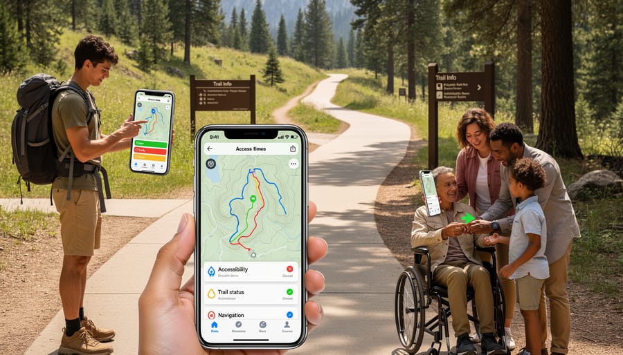
Interactive Trail Maps and Route Planning
Gone are the days of wondering whether a trail will work for your mobility needs. Modern interactive trail maps have revolutionized outdoor planning, putting essential accessibility details right at your fingertips. Apps like AllTrails and TrailLink now include user-generated accessibility reviews, while many Ontario provincial parks offer detailed digital maps highlighting wheelchair-accessible routes, surface conditions, and gradient information.
When planning your adventure, look for maps that show elevation profiles – these visual representations reveal hills and inclines that might pose challenges. My friend Sarah, who uses a power wheelchair, swears by checking surface descriptions before heading out. She’s learned that “packed gravel” usually means smooth sailing, while “natural surface” often requires more careful consideration.
Most digital mapping tools now mark accessible parking spots, barrier-free washrooms, and picnic areas with adaptive tables. Insider tip: download maps before you go, as cell service can be spotty in remote areas. Many parks also offer printable PDF versions with accessibility features clearly marked.
Take advantage of filters that let you search by distance, surface type, and amenities. This personalized approach means you’re not just hoping a trail works – you know it will. Planning ahead transforms potentially stressful outings into confident adventures where everyone can focus on enjoying Ontario’s natural beauty.
Virtual Tours and 360-Degree Views
Before you head out, why not take a virtual stroll first? Virtual tours and 360-degree photography are game-changers for planning accessible outdoor adventures. Many Ontario parks now offer immersive online experiences that let you explore trails, facilities, and viewpoints from your couch. You can check out boardwalk widths, identify rest areas, and spot potential obstacles before packing your bag.
I remember a friend who uses a wheelchair being thrilled to discover a park’s virtual tour showed exactly where the accessible fishing dock was located and how to reach it. That pre-visit confidence made all the difference in her experience.
Here’s an insider tip: these virtual tools aren’t just about accessibility planning. They’re eco-friendly too! By previewing parks online, you can make informed decisions about which locations truly meet your needs, reducing unnecessary drives and carbon emissions from trial-and-error visits.
Look for parks offering Google Street View integration or dedicated virtual tour pages on their websites. Some even include detailed audio descriptions. This technology transforms trip planning from stressful guesswork into an empowering preview that helps everyone, regardless of mobility, vision, or other needs, choose their perfect outdoor destination with confidence.
Communication and Support Tools
Planning your accessible outdoor adventure has never been easier, thanks to modern communication tools that put crucial information at your fingertips. Many Ontario parks now feature digital reservation systems with dedicated accessibility notes—I discovered this gem when booking a campsite for my cousin who uses a wheelchair. These systems often include detailed filters for accessible facilities, surface types, and proximity to amenities, saving you hours of phone calls.
Here’s an insider tip: take advantage of online chat support offered by many park websites. Real staff members can answer specific questions about trail conditions, accessible parking locations, or wheelchair-friendly fishing spots that generic descriptions might miss. I’ve found park staff incredibly knowledgeable and eager to help plan the perfect visit.
Don’t overlook community forums and social media groups where visitors share real-world accessibility experiences. These platforms offer honest reviews, recent photos of trail conditions, and creative solutions others have discovered. One forum member shared how to navigate a popular lookout using an alternative route—information that made all the difference for our group. These peer-to-peer connections create an eco-friendly way to gather current information while building a supportive community of outdoor enthusiasts who understand your needs.
Insider Tips for Maximizing Digital Accessibility Tools
Ready to unlock the full potential of digital accessibility tools? Here are some game-changing tips we’ve gathered from park rangers, accessibility coordinators, and visitors who’ve mastered these resources.
First, download maps and trail information before you leave home. While most Ontario parks have decent connectivity near visitor centers, signal strength drops significantly on trails. Save offline versions of accessibility guides and GPS coordinates to your device. Pro tip: take screenshots of key information like accessible parking locations and washroom facilities.
When using park apps, enable your phone’s text-to-speech features to have trail descriptions read aloud while you navigate. This keeps your eyes free to enjoy the scenery and watch for uneven terrain. Many experienced visitors recommend pairing this with bone-conduction headphones, which let you hear both audio descriptions and natural sounds around you.
Here’s an insider secret from Algonquin Park staff: call ahead and ask about seasonal accessibility changes. Digital tools show general information, but rangers know which boardwalks have recent repairs, where beaver activity might affect water levels on accessible routes, and which viewpoints currently offer the clearest sightlines. This real-time knowledge makes all the difference.
For eco-conscious explorers, consider downloading nature identification apps like iNaturalist alongside accessibility tools. You can document plants and wildlife along accessible trails, contributing to citizen science while enjoying barrier-free outdoor experiences. It’s a wonderful way to deepen your connection with Ontario’s ecosystems.
Battery life matters outdoors. Bring a solar-powered charger or portable battery pack rated for at least two full phone charges. Cold weather drains batteries faster, so keep devices in inside pockets when not actively using them.
Finally, share your experiences. After visiting, leave detailed reviews on park websites and accessibility apps. Mention specific features like whether wheelchair-accessible picnic tables have enough shade, or if visual contrast markers on trails are actually visible. Your feedback helps future visitors and encourages parks to maintain these crucial resources.
Parks Leading the Way in Digital Accessibility
Several Ontario parks are setting the gold standard for digital accessibility, making it easier than ever to plan inclusive outdoor adventures.
Algonquin Provincial Park has become a pioneer in this space with its comprehensive digital accessibility features. Their website offers detailed trail descriptions that include grade percentages, surface types, and even seasonal condition updates. What really sets them apart is their virtual tour feature, allowing visitors to preview trails and facilities before arriving. One family shared how they used these tools to find the perfect boardwalk trail for their grandmother’s wheelchair, turning what could have been a stressful guessing game into a confident, joyful outing.
Presqu’ile Provincial Park takes accessibility information to another level with its interactive accessibility map. The digital tool lets you filter by mobility needs, visual requirements, and hearing accommodations. Their beach access points are clearly marked online with photos showing the exact pathway conditions. A local accessibility advocate told us this feature helped them discover that the park’s accessible beach matting extends further than most Ontario beaches, making water access genuinely possible for wheelchair users.
Frontenac Provincial Park deserves recognition for their detailed PDF accessibility guides that work seamlessly with screen readers. They’ve included GPS coordinates for accessible parking spots and rest areas, which outdoor enthusiasts using mobility devices say makes navigation infinitely easier. The park’s commitment to keeping this information current, with monthly updates during peak season, shows they understand that accessibility needs evolve.
These accessible parks worth exploring prove that thoughtful digital tools transform outdoor experiences, removing barriers before visitors even leave home.
What’s Coming Next: The Future of Accessible Outdoor Experiences
The future of outdoor accessibility is absolutely thrilling, and it’s arriving faster than you might think! Technology is opening doors (and trails) in ways we couldn’t have imagined just a few years ago.
Picture this: You’re hiking a trail wearing augmented reality glasses that overlay visual descriptions of bird calls for deaf and hard-of-hearing visitors, or provide audio narration of scenic vistas for those with visual impairments. Several Ontario parks are already piloting AR features that bring interpretive signs to life with interactive 3D models and multi-sensory information. Game-changer doesn’t even begin to cover it.
AI-powered accessibility assistants are another exciting development on the horizon. Think of them as your personal outdoor guide, providing real-time updates about trail conditions, weather changes, and even suggesting route modifications based on your specific needs and energy levels. Some early versions are already being tested, learning from thousands of park visits to offer increasingly personalized recommendations.
Here’s my insider tip: Ontario Parks has committed to making accessibility improvements an ongoing priority, not a one-time checkbox. They’re actively seeking feedback from visitors with disabilities to guide future enhancements. Your voice literally shapes what comes next.
Sensory accessibility features are expanding too, with plans for more tactile trail markers, scent gardens designed for navigation, and soundscape maps that help visitors orient themselves through natural audio cues.
The message is clear: accessible outdoor experiences will only get better, more innovative, and more inclusive. The wilderness is for everyone, and technology is helping prove it.
Ontario’s natural wonders have always been here, waiting for everyone to experience them. What’s changed is our collective understanding that accessibility isn’t a special accommodation—it’s simply good design that benefits all visitors. The digital tools we’ve explored together represent more than just technological advancement; they’re doorways to adventure, independence, and connection with the landscapes that make this province extraordinary.
Whether you’re using a wheelchair-accessible trail app to find your next forest path, checking real-time facility information before heading to a waterfront park, or downloading audio descriptions for a guided nature walk, these resources put the power of exploration directly in your hands. I’ve watched these tools transform hesitant plans into confident excursions, turning “I wish I could” into “I absolutely will.”
Here’s my insider tip: start small. Choose one familiar park, explore its accessibility features using these digital tools, and build from there. Each successful outing builds confidence for the next adventure.
The trails, beaches, and forests of Ontario are calling. It’s time to plan your accessible adventure and discover that nature truly does belong to everyone.


+ There are no comments
Add yours