

An interactive geological time scale is a digital or physical tool that lets you explore Earth’s 4.6-billion-year history through clickable layers, timelines, and visual representations of the major eras, periods, and epochs that shaped our planet. Think of it as a roadmap through deep time, one that brings ancient oceans, volcanic eruptions, and long-extinct creatures to life right before your eyes.
For anyone heading out to explore Ontario’s parks and conservation areas, these tools transform random-looking rock outcrops into vivid storytellers. That cliff face at Killarney Provincial Park? It’s part of the Canadian Shield, some of the oldest exposed rock on Earth, dating back over a billion years. The limestone along the Niagara Escarpment holds fossils from tropical seas that covered Ontario roughly 400 million years ago. Without an interactive time scale to ground you, those numbers feel impossibly abstract. With one, you suddenly grasp where you stand in the grand sweep of planetary history.
This article walks you through what interactive geological time scales are, how they work, the different types you’ll encounter (from museum touchscreens to smartphone apps), and practical ways to use them on your next outdoor adventure. Whether you’re a Scout leader planning a geology badge activity, a parent hoping to spark curiosity in your kids, or simply someone who wants to understand what you’re looking at when you hike past billion-year-old bedrock, mastering these tools opens up a whole new dimension of exploration. You’ll leave the trail not just having seen cool rocks, but having traveled through time itself.
What an Interactive Geological Time Scale Actually Means
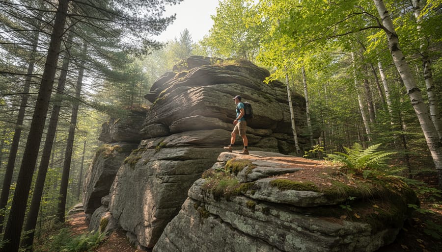
An interactive geological time scale is a dynamic visual timeline that maps Earth’s entire 4.6-billion-year history, designed so you can actively explore it rather than just read about it. Instead of flipping through static textbook pages, you tap a screen, scan a QR code, or point your smartphone at a rock formation to see when and how it formed. Think of it as Earth’s biography made touchable.
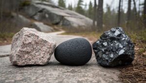
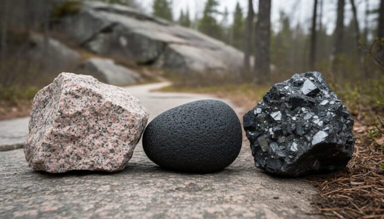
These tools transform abstract geological concepts into something you can grasp while standing in front of actual ancient rocks. When you’re hiking through Ontario’s Canadian Shield and spot a chunk of pink granite, an interactive time scale lets you zoom to the Precambrian era, roughly 1 to 2.5 billion years ago, and understand that you’re literally touching one of the oldest surfaces on the planet. The rock doesn’t change, but your connection to it does.
- Geological Eons
- The largest divisions of Earth’s history, spanning hundreds of millions to billions of years. Ontario’s visible rocks come primarily from the Precambrian eon.
- Periods and Epochs
- Smaller time segments within eons, each marked by distinct climate shifts and life forms. Interactive scales let you jump between these to see what Ontario looked like during each.
- Formations
- Specific rock layers or geological features created during identifiable time windows. Interactive tools help you match the formation you’re standing on to its exact age and origin story.
- Interactive Elements
- Digital features like touch controls, zoom functions, AR overlays, and clickable layers that turn passive reading into active discovery.
The key difference from old-school timelines is participation. You’re not memorizing dates, you’re investigating them, matching what you see on the trail to moments in deep time. A traditional chart tells you the Ordovician period happened 485 to 444 million years ago. An interactive scale shows you fossilized sea creatures from that era, then points you toward Ontario parks where those same fossils appear in limestone outcrops you can visit this weekend.
How Interactive Geological Time Scales Work
Digital Platforms and Apps
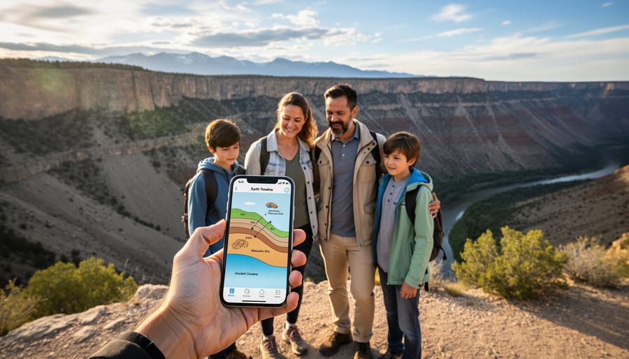
Smartphone apps have become surprisingly good at turning geological time into something you can swipe through while sitting in your tent. Tools like the Geological Society of America’s Geologic TimeScale app let you zoom from the formation of Earth down to specific periods when Ontario’s bedrock was created, complete with animations showing continental drift and ancient climates. You can literally scroll backward 1.2 billion years to see what the Canadian Shield looked like during its formation.
Web-based platforms work similarly but offer more screen real estate for detailed exploration. Before your camping trip, you can use browser-based interactive timelines to research which geological periods you’ll encounter at your destination, then bookmark specific formations to look for on the trail.
Many Ontario park visitor centers now feature touchscreen kiosks with custom geological timelines tied to local formations. These installations often include photos of actual rock samples from nearby trails, letting you match what you’ll see outdoors with its place in Earth’s timeline. The touch interface makes it easy for kids to explore different eras while parents plan the day’s hike, turning wait time into learning time without feeling like homework.
Physical Installations in Parks
When you arrive at an Ontario park with geological significance, you’ll often encounter physical installations designed to bring deep time into focus. The most common are interpretive panels positioned near notable rock outcrops or trailheads. These weatherproof displays feature illustrated timelines, formation diagrams, and photographs showing what the landscape looked like millions of years ago.
Many panels now include QR codes you can scan with your phone, linking to detailed videos, 3D models of ancient environments, or supplementary information about specific rock layers. Some parks have embedded augmented reality markers, point your device at a rock face, and the app overlays labels identifying its age and formation process right on your screen.
Visitor centers at geological hotspots sometimes house touchscreen kiosks with interactive maps. You tap a rock type, and the display zooms to the corresponding era on Earth’s timeline, showing which ancient ocean or volcanic event created it. Trail-side markers along interpretive loops often include tactile elements: polished rock samples mounted beside their timeline position, letting you literally touch a piece of the Precambrian while reading about its billion-year journey.
Different Formats You’ll Encounter
You’ll find interactive geological time scales in several formats as you explore Ontario’s parks and natural areas, each designed to work in different settings and suit different learning styles.
Museum and visitor center touchscreens offer the most comprehensive experience. These large displays let you pinch, zoom, and slide through billions of years, often with rotating 3D models of ancient continents and extinct creatures that once roamed Ontario. Many feature “then and now” comparisons showing how the Canadian Shield looked during different eras.
Out on the trail, you’ll encounter a mix of low-tech and high-tech options:
- Museum touchscreen exhibits with zoomable timelines and 3D reconstructions
- Park-specific mobile apps that sync with your GPS location
- Geological trail markers with QR codes linking to detailed formation histories
- Web-based interactive timelines you can explore from home or your campsite
- Augmented reality experiences that overlay ancient landscapes onto your phone’s camera view
Trail-side interpretive markers have evolved beyond static plaques. Modern installations combine weatherproof panels with QR codes you scan to unlock videos, age calculators, and virtual fossil collections. Some geocaching trail routes now incorporate geological checkpoints where you log rock formations alongside traditional cache finds.
Mobile apps represent the most flexible format. Download one before you lose cell service, and you’ll have a portable geological library. Point your camera at a rock outcrop, and the app suggests possible formations and periods. Some include offline maps showing where to find specific rock types, turning your hike into a targeted time-hunting expedition.
The newest format, augmented reality, overlays ancient environments onto your current view. Hold up your phone at a lookout, and watch a Cambrian sea ripple where forest now stands, or see glaciers retreat across the landscape. It’s particularly effective for kids who struggle to visualize “500 million years ago” without something concrete to anchor the concept.
How to Use These Tools on Your Next Park Adventure
Before You Hit the Trail
Before you lace up your hiking boots, spend twenty minutes with an online interactive geological time scale. Start by identifying which geological period dominates your destination, Ontario’s Canadian Shield rocks typically date back 1 to 2.7 billion years to the Precambrian era. Search for your specific park name plus “geology” to find interpretive guides that explain what you’ll see underfoot.
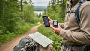
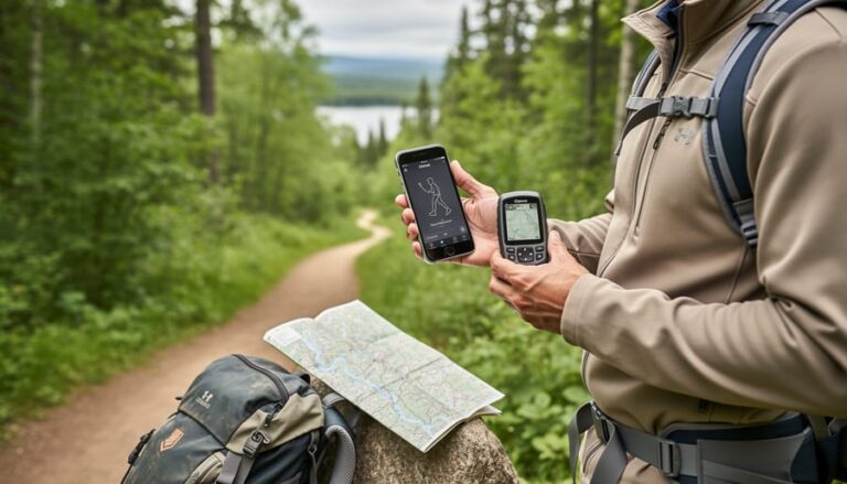
Cross-reference the time scale with aerial maps of your route to pinpoint where exposed bedrock appears along trails. Mark these spots on your physical map or GPS so you can pause there with the geological context fresh in mind. Look up key terms you’ll encounter, gneiss, granite, basalt, and note their approximate ages so you can identify them on-site.
Download any available park-specific geological guides or apps while you still have WiFi. Many Ontario parks offer PDFs showing which rock formations appear where, turning your hike into a treasure hunt through deep time rather than just a walk in the woods.
During Your Hike or Camp
Once you’re on the trail, your phone becomes a pocket-sized geology lab. When you spot an interesting rock formation, pull up your interactive time scale app and snap a photo or check the GPS coordinates. Many apps will show you what geological period you’re standing in, literally. That chunk of pink granite? It formed 1.3 billion years ago during the Mesoproterozoic Era, when Ontario sat near the equator under a shallow sea.
On-site installations make this even simpler. Scan QR codes on interpretive panels with your phone to reveal layered timelines, animated reconstructions of ancient landscapes, and close-up diagrams of the rock you’re examining. Some parks offer augmented reality features that overlay prehistoric scenes onto your camera view, showing the volcanic activity or glacial movements that shaped what you’re seeing today.
Remember to practice respectful exploration. Photograph rocks instead of collecting them, it keeps formations intact for other visitors and maintains the park’s geological integrity. Use the leave no trace principles when examining sites: stay on marked trails, avoid disturbing moss or lichen growing on rock faces, and never chip samples or scratch surfaces. The beauty of interactive tools is you can capture all the information digitally without taking physical souvenirs, preserving Ontario’s ancient story for future explorers while building your own geological knowledge.
Where to Find Interactive Geological Resources in Ontario
Ontario’s ancient bedrock is everywhere, but finding the right tools and places to explore it interactively takes a bit of planning. Fortunately, several parks, museums, and online resources across the province make geological time scales accessible to curious visitors.
Start with provincial parks that sit on some of North America’s oldest exposed rock. These Ontario geological sites often feature interpretive centers with touchscreen displays, trail markers with QR codes linking to geological timelines, and naturalist-led programs that connect the rocks underfoot to Earth’s deep history:
- Frontenac Provincial Park showcases billion-year-old Precambrian granite and gneiss with trail-side interpretation panels
- Killarney Provincial Park features the white quartzite ridges of the La Cloche Range with geological context at its visitor center
- Bruce Peninsula formations display ancient limestone reefs from tropical seas, with interpretive signage throughout the park
- Royal Ontario Museum in Toronto offers interactive digital exhibits exploring Ontario’s geological past through touch screens and 3D models
- Ontario Geological Survey website provides free downloadable maps, rock identification guides, and interactive regional geology browsers
Many parks now partner with universities to install augmented reality markers at significant rock formations, just point your phone’s camera at the marker to see what the landscape looked like millions of years ago. Visitor centers typically stock printed geological timelines you can carry on the trail, and park naturalists can point you toward the best spots to see specific rock types. For pre-trip planning, the Ontario Geological Survey’s online portal lets you explore interactive maps showing rock ages across the province, helping you target areas that match your geological interests before you even pack the tent.
Common Questions About Geological Time Scales
When you start exploring Ontario’s geological story, a few practical questions naturally come up. Here’s what most campers and outdoor enthusiasts want to know before they dive into interactive geological time scales.
How old are Ontario’s rocks actually?
Most of Ontario’s bedrock belongs to the Canadian Shield, with rocks ranging from 1 to 2.7 billion years old. The oldest formations you’ll encounter while camping date back to the Precambrian era, making them among Earth’s most ancient exposed surfaces.
What geological period will I see most often on trails?
The Precambrian dominates Ontario’s landscape, particularly in parks across the Shield region. You’ll mainly encounter granite, gneiss, and other igneous and metamorphic rocks that formed deep underground before complex life even existed on Earth.
Do I need special equipment to use these tools?
Not really. Most interactive geological time scales work on any smartphone or tablet with internet access, though some park installations use touchscreens or QR codes you can scan with your camera. A basic magnifying glass helps for examining rock textures up close.
Can kids actually understand geological time scales?
Absolutely. Interactive versions translate billions of years into relatable concepts like comparing Earth’s age to a 24-hour clock or showing dinosaurs and ice ages visually. Most tools designed for parks include kid-friendly features with simplified timelines and fun facts that make deep time surprisingly graspable for young explorers.
Are these resources available without cell service?
Many apps let you download regional geological data before your trip, which is smart since Ontario’s backcountry often lacks coverage. Physical installations at trailheads and interpretive centers work entirely offline, and some parks offer printed guides that complement the interactive experience.
One question that comes up less often but matters: accuracy varies between tools. Apps tied to government geological surveys or university research tend to be more precise than general tourism apps. When you’re serious about identifying what you’ve found, cross-reference between a couple of sources. And remember, rocks don’t change, so even a tool that hasn’t been updated in a few years will still correctly identify a billion-year-old granite formation.
Standing on a rocky outcrop in Ontario, you’re not just looking at stone, you’re touching a billion-year-old chronicle of erupting volcanoes, tropical seas, and ice ages that sculpted the Canadian Shield. Interactive geological time scales transform these ancient whispers into conversations, turning a simple hike into a journey through deep time.
Whether you’re using a smartphone app to identify the Precambrian gneiss beneath your boots, scanning a QR code at a trailhead to watch Ontario’s landscape shift through the eons, or gathering your family around a touchscreen display at a visitor center, these tools make the planet’s epic story accessible and thrilling. They answer the questions that pop up when you spot colorful minerals or layered rock faces: What am I looking at? When did this form? What lived here?
Next time you pack for a camping trip or day hike, bring curiosity about the ground beneath your tent. Ontario’s rocks have been waiting a billion years to tell their story. With interactive geological time scales, you finally have the perfect translator. The adventure isn’t just across the landscape, it’s through time itself.




+ There are no comments
Add yours