
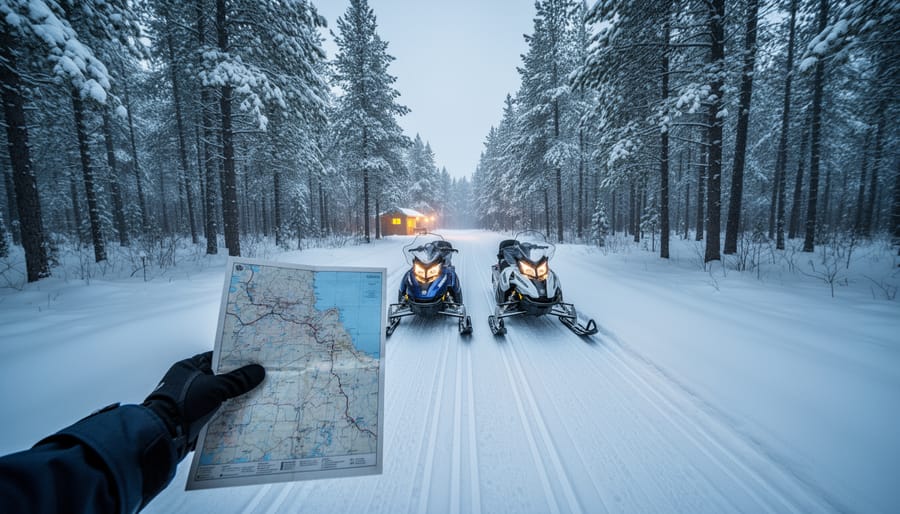
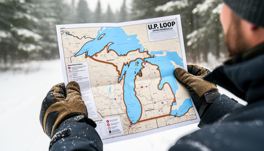
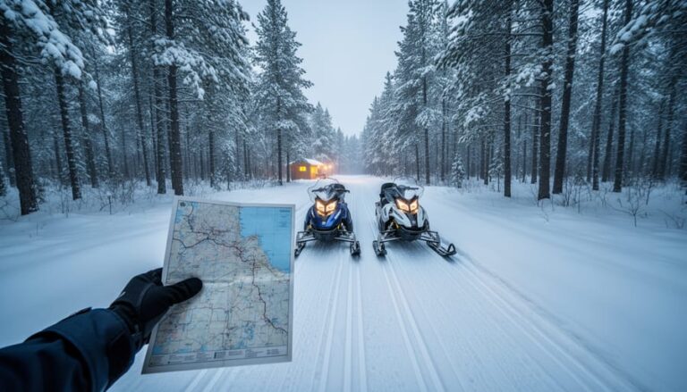
Michigan’s Upper Peninsula snowmobile trail system stretches across more than 6,000 miles of groomed paths, and obtaining a detailed trail map is your first step to planning epic circular routes that return you to your starting point. The U.P. Trail Map is available free online through the Michigan Department of Natural Resources and local snowmobile associations, while printed versions can be picked up at visitor centers, gas stations, and lodging throughout the region. These maps show the entire numbered trail network, including the popular 2, 3, 8, and 13 corridors that form the backbone of most multi-day loops.
For Ontario riders making the cross-border trip, understanding the U.P.’s trail numbering system transforms what looks like a web of confusing lines into logical loop opportunities. The numbered trails function like highways, connecting towns, gas stops, and warming huts in predictable patterns. Planning a loop means choosing your base town, identifying which numbered trails radiate from it, and sketching a circular route that brings you back after hitting the scenery and communities you want to experience. The DNR map shows trail conditions color-coded by status, but local snowmobile association websites provide real-time grooming reports that are essential for route decisions. You’ll also want to note the fuel stops marked on the map, since some loops push sleds to their range limits between stations.
Why the U.P. Trail System Is Worth the Journey
Michigan’s Upper Peninsula has earned its reputation as one of North America’s finest snowmobiling destinations, and for Ontario riders willing to make the cross-border trip, the rewards are substantial. With over 6,000 miles of groomed trails crisscrossing the region, the U.P. offers something no single jurisdiction can match: endless variety packed into a rider-friendly system that actually makes sense once you learn how it works.
The trail network here stands out for several compelling reasons:
- Consistent grooming maintained by dedicated local clubs who take pride in their sections
- Terrain that shifts from Lake Superior coastal routes to dense hardwood forests and open farmland
- Trail towns spaced perfectly for refueling, warm-up breaks, and overnight stays
- Numbered routes that connect seamlessly across county lines for true multi-day adventures
- Snow reliability from lake-effect systems that often deliver when other regions go bare
Understanding the trail numbering system unlocks the region’s potential. Main corridor trails carry numbers (Trail 2, Trail 8, Trail 3), while spur routes add letters (Trail 2A, Trail 8B). County connector trails use their own numbering, but the system is logical: follow the signs, and you can ride from Ironwood to Sault Ste. Marie without retracing your path. This interconnectedness turns what could be out-and-back rides into proper loop itineraries where each day brings new scenery.
The U.P. gets an average of 200 inches of snow annually in many areas, with lake-effect bands often keeping trails rideable well into March. Combine that reliability with landscapes ranging from Superior’s rocky shoreline to the Keweenaw’s historic mining country, and you have terrain that stays interesting mile after mile. Communities here understand snowmobiling isn’t just recreation, it’s winter’s economic lifeline, which translates to genuinely welcoming trail towns where riders are valued customers, not tolerated noise.
Top Snowmobile Trail Loop Itineraries in the U.P.
1. Keweenaw Peninsula Grand Loop
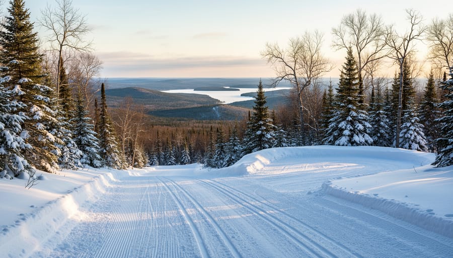
The Keweenaw Peninsula Grand Loop delivers what many riders consider the pinnacle of Upper Peninsula snowmobiling: a 200-plus-mile journey through rugged terrain that feels genuinely remote despite excellent trail infrastructure. This route circles the northernmost tip of Michigan, where Lake Superior shapes both the landscape and the snow conditions.
Starting from Houghton, you’ll follow Trail 3 north through the spine of the peninsula. The terrain shifts dramatically as you climb, gentle rolling hills give way to steep ridges that offer panoramic views of both Keweenaw Bay and the lake’s open waters. On clear days, the vistas from these high points are breathtaking, with forested valleys stretching toward ice-edged shorelines.
Copper Harbor marks the turnaround point at mile 100. This tiny village transforms into a snowmobiling hub each winter, and the ride there takes you through dense hardwood forests and past abandoned copper mine structures that tell the region’s industrial story. The return leg follows Trail 134 and connects through Phoenix and Delaware, tracing the peninsula’s eastern shore.
What sets this loop apart is the genuine wilderness character. You’ll ride for stretches where services are sparse and cell coverage patchy, part of the appeal for experienced riders. The trail surface is typically excellent (local clubs take grooming seriously), but the terrain demands respect. Expect elevation changes, tight forest corridors, and exposed ridgetop sections where wind can reshape snow conditions quickly.
Budget two full riding days minimum, though three lets you explore side trails to ghost towns like Central and enjoy Copper Harbor without rushing. The historic Keweenaw Mountain Lodge in Copper Harbor makes a perfect halfway point, or you can overnight in Calumet for more dining options.
2. Watersmeet Triangle Loop
The Watersmeet Triangle Loop delivers 150 to 180 miles of prime riding through the heart of Wisconsin and Michigan’s border country, where dense boreal forest meets hundreds of glacial lakes. This route connects Watersmeet, Land O’Lakes (Wisconsin), and Boulder Junction (Wisconsin) before looping back, creating a natural triangle that showcases the region’s wild character without the extreme remoteness of northern routes.
What sets this loop apart is the variety. You’ll cross frozen lakes on marked ice trails, carve through towering stands of white pine and hemlock, and navigate rolling terrain that keeps things interesting without punishing less experienced riders. The frequent lake crossings, some spanning a half-mile or more, offer breathtaking open vistas and a welcome change from the tree-lined corridors. Watch for eagle sightings near open water areas and deer tracks crossing your path.
Trail 2 forms the backbone of this route, connecting with Trail 13 near Watersmeet and linking to Wisconsin’s extensive system near Land O’Lakes. The grooming is typically excellent, maintained by dedicated local clubs who take pride in their trails. You’ll find gas, food, and warm-up spots at regular intervals, making this loop forgiving for riders still building their endurance or testing new equipment.
The terrain demands solid intermediate skills. Expect some hills, tight corners through the forest, and the need to read ice conditions on lake crossings. But there’s nothing here that should intimidate a confident rider, and the payoff is substantial: wildlife encounters, stunning wilderness scenery, and the satisfaction of completing a multi-day adventure through country that feels genuinely remote without being inaccessible. Most groups complete this loop comfortably over two to three days.
3. Lake Superior Shoreline Route
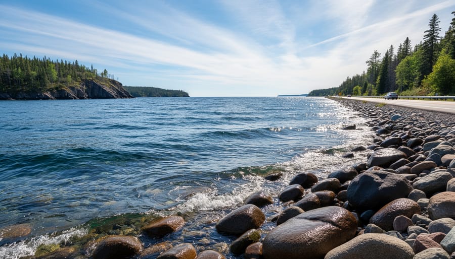
The Lake Superior Shoreline Route delivers something you won’t find on inland trails: the constant presence of the world’s largest freshwater lake stretching to the horizon. This 200-plus-mile loop traces Superior’s southern coastline through Alger and Luce counties, connecting Munising, Grand Marais, and Paradise while offering breathtaking lake views that Ontario riders traveling the North Shore will find equally spectacular from the Michigan side.
What sets this route apart is the dramatic contrast between protected forest corridors and exposed shoreline stretches. You’ll ride through dense hardwood stands, then emerge onto open terrain where Lake Superior dominates the landscape. The trail crosses several inland rivers feeding the lake, passes within sight of frozen beaches, and provides winter access to attractions like Miners Falls and Wagner Falls near Munising. Grand Marais, roughly the loop’s midpoint, offers genuine trail town hospitality with restaurants and lodging geared toward snowmobilers arriving cold and hungry.
This route demands respect for weather conditions. Being this close to Superior means you’re exposed to lake-effect snow systems that can reduce visibility quickly and create drifting across open sections. The same geography that produces Michigan’s most reliable snow totals can also generate challenging riding conditions. Check marine forecasts alongside trail reports, and be prepared for temperature drops near the shoreline.
Trail 8 forms the primary artery for this loop, with connections to Trail 41 and local spurs leading into communities. The eastern portion between Grand Marais and Paradise tends to be more sheltered, while western sections offer those iconic lake panoramas. Plan two full riding days minimum to appreciate both the scenery and the character of each trail town along the way.
4. Escanaba to Iron Mountain Explorer
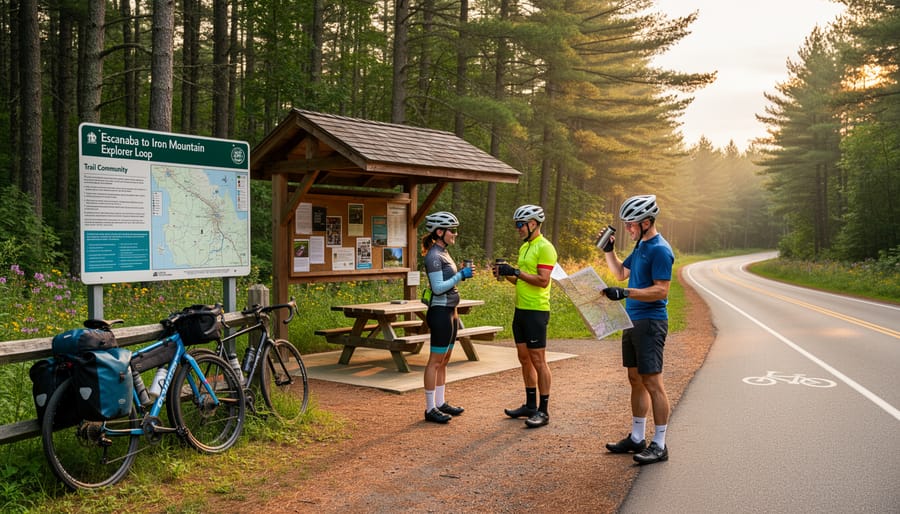
This southern U.P. route offers something many northern loops don’t: consistent services and a gentler introduction to multi-day riding. The Escanaba to Iron Mountain Explorer covers roughly 150 miles through Delta and Dickinson counties, making it manageable for groups with varying skill levels or families looking to experience the U.P. without committing to remote wilderness sections.
The terrain here differs from the rugged, heavily forested northern routes. You’ll ride through working forests interspersed with open farmland, giving you broader sight lines and a less claustrophobic feel than dense pine corridors. The trails tend to be wider and better maintained, thanks to well-funded local clubs and easier groomer access. This mix makes the route forgiving for riders still building confidence on longer trips.
Both Escanaba and Iron Mountain function as full-service towns with multiple lodging options, restaurants, grocery stores, and dealerships. You’re never more than 30 miles from fuel or a warm meal. Smaller communities like Norway and Gladstone along the route offer additional stopping points with local diners and gas stations. This infrastructure safety net matters when you’re traveling with less experienced riders or families.
The historical element adds interest beyond just riding. Iron Mountain’s name isn’t just colorful, this was serious mining country, and you’ll pass remnants of that heritage along the trails. Norway features a massive ski jump visible from nearby routes, and Escanaba’s waterfront provides a natural endpoint with Lake Michigan views.
Trail connections here link to both north-south routes if you want to extend your trip and east-west paths heading deeper into the U.P. The network’s flexibility lets you easily shorten or lengthen your daily mileage based on how your group feels.
5. Sault Ste. Marie Eastern Loop
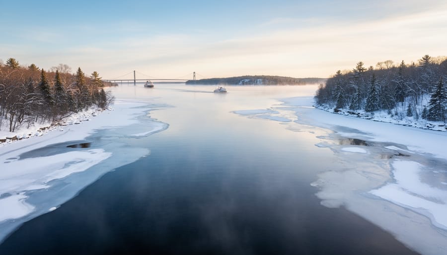
Starting from Sault Ste. Marie (locally known as “the Soo”), this 120-160 mile loop offers Ontario riders the shortest cross-border jump into Michigan’s trail system. The route runs south through Chippewa County into Luce County before circling back north, creating a manageable weekend itinerary that showcases eastern U.P. character without requiring extensive time commitments.
Trail 8 serves as your primary corridor heading south from the Soo, cutting through dense mixed forests and rolling terrain that transitions from hardwoods near the St. Marys River to thick pine stands deeper into the interior. The landscape here feels different from western U.P. routes, less dramatic perhaps, but offering a quieter, more intimate wilderness experience with frequent wildlife sightings, especially white-tailed deer and occasional moose.
The loop passes through small communities like Strongs and Eckerman, where you’ll find essential services and genuine local hospitality. Newberry, the Luce County seat, marks your southernmost point and offers full amenities including multiple gas stations, restaurants, and lodging options. From there, you can extend eastward on Trail 49 toward Tahquamenon Falls State Park or loop back north through different terrain.
What sets this route apart for Ontario riders is flexibility. You’re never more than 40 miles from the international border, making it ideal for testing U.P. trails before committing to deeper adventures. The cultural connection runs strong here too, many Soo residents have family ties across the border, and you’ll find familiar Tim Hortons coffee and Canadian currency accepted in some establishments.
Before crossing, verify that your Ontario trail permit qualifies under reciprocal agreements and that your sled meets Michigan’s current registration requirements. Border wait times vary, so plan accordingly.
Getting Your U.P. Trail Maps: Resources and Tools
The Michigan Department of Natural Resources offers the most authoritative trail maps through their Parks and Recreation Division website, where you can download county-by-county PDFs showing current trail designations and connections. These official DNR maps cover the entire Upper Peninsula system but lack fine detail on services and local conditions. For richer information, turn to individual county snowmobile associations, groups like the Keweenaw Trail Committee, Gogebic County Trail Authority, and Delta-Schoolcraft Trail Association publish their own maps with marked gas stations, warming shelters, lodging, and real-time grooming updates. You’ll find these on association websites or at local visitor centers and trailhead kiosks.
Regional overview maps show the big picture, major numbered trails and how they interconnect across county lines, making them useful when sketching out multi-day loop itinerary tips and understanding which routes link together. County maps zoom in on specific areas, displaying shelter locations, trail difficulty grades, and alternate spurs. Both types are valuable: start with an overview to plan your loop, then grab county maps for the areas you’ll ride through.
| Source | Format | Cost | Detail Level | Best Use |
|---|---|---|---|---|
| Michigan DNR | PDF download | Free | Moderate | Official route reference, planning |
| County associations | Print, PDF | Free or donation | High | Local services, grooming status |
| Mobile GPS apps | Digital, real-time | Free to subscription | Very high | On-trail navigation, live conditions |
Mobile apps like Polaris RideCommand, OnX Offroad, and TrailsOffroad overlay GPS coordinates onto trail maps, showing your position in real time and letting you track your route. Many sync grooming reports and closure alerts, which paper maps cannot. Download maps for offline use before you ride, since cell coverage is spotty in remote U.P. forests.
Trail markers use a standardized system: circular confidence markers with trail numbers confirm you’re on the right route, while rectangular signs indicate intersections, distances, and services. Grooming symbols (usually a snowflake or groomer icon) on maps and trailside boards tell you which routes receive regular maintenance. Difficulty ratings range from easy (wide, flat) to more challenging (hilly, narrow, or ungroomed sections), though most U.P. trails suit intermediate riders comfortably.
Planning Your Loop: Timing, Permits, and Logistics
The U.P. trail system operates reliably from mid-December through late March, with peak conditions typically arriving in January once consistent lake-effect snow blankets the region. Early season riders should check local snow reports, many loops won’t fully open until accumulated snowpack reaches grooming depth, which varies by elevation and county. Late February often delivers the best combination of deep snow, stable weather, and longer daylight hours, though March can surprise you with excellent conditions if temperatures cooperate.
Before you cross the border, understand Michigan’s permit system. Every snowmobile operating on state trails needs a valid snowmobile trail permit required by the DNR, available online or at registration agents throughout the U.P. Ontario residents can purchase three-day ($36.25) or annual ($51.25) non-resident permits, both are valid immediately and help fund the grooming that makes these trails exceptional. You’ll also need to carry valid registration from your home province and proof of insurance meeting Michigan’s minimum liability coverage.
When you plan a northern loop build your daily mileage around realistic fuel stops and meal breaks. Most riders comfortably cover 100-150 miles per day, but terrain, group experience, and photo stops will affect your pace. Gas stations cluster in larger towns like Munising, Houghton, and Iron Mountain, but rural stretches can exceed 50 miles between services, carry a reserve fuel can on remote loops. Mapping your overnight stops early is critical during peak season; lodges along the Keweenaw and Lake Superior routes book months ahead for weekends.
Lodging options range from snowmobile-specific motels with heated garages and trail-side access to rental cabins that accommodate larger groups. Many establishments offer shuttle services if mechanical issues arise, and they’ll gladly share current trail intel over breakfast. For eco-conscious travel, stay exclusively on marked trails to prevent habitat fragmentation, reduce speed near wildlife corridors (dawn and dusk especially), and pack out everything you bring in. Supporting local businesses, buying gas, eating at trail cafes, staying at independent lodges, directly funds the trail maintenance systems and volunteer grooming clubs that keep this network world-class.
Local Tips from the Trail
Trail veterans know success in the U.P. comes down to local knowledge as much as having the right map. Start each day by checking grooming reports through the Michigan Snowmobile and ORV Association’s online portal or calling county trail hotlines, conditions can shift overnight, and locals update these daily. Download the MSA TrailsHub app before you arrive; cell service gets spotty in remote areas, but the offline maps and recent rider comments prove invaluable when you’re 50 miles from the nearest town.
Fuel planning requires more attention here than back home. Gas stations close earlier in small trail towns, and Sunday hours can be limited. Locals swear by keeping your tank above half-full and carrying a jerry can for the longer wilderness stretches like the Keweenaw backcountry. For warming up, trail-side bars and cafes genuinely welcome sledders, you’ll see parking lots full of machines at places like The Antler’s in Curtis or The Library Sports Bar & Grill in Trout Creek. Buy something hot, tip well, and you’re supporting the communities that maintain these trails.
- Trail conditions: Call county hotlines or check MSA TrailsHub daily for grooming updates
- Emergency contacts: Program Chippewa County 911 (906-635-6565) and DNR Law Enforcement (800-292-7800) into your phone
- Rider etiquette: Stay right, slow for oncoming traffic on hills, and never block trail intersections
- Support local: Purchase permits, eat at trail-side restaurants, and leave positive reviews for snowmobile-friendly businesses
U.P. riders take pride in their trail system and expect visitors to respect it. That means staying on marked routes, wandering onto private land damages landowner relationships that keep trails open. Pack out all trash, give wildlife wide berth, and resist the urge to highmark pristine slopes visible from the trail. Just as you’d choose the right gear for backcountry adventures, select your riding behavior to preserve access for future seasons.
Weather shifts fast here. Monitor NOAA forecasts and understand that lake-effect snow can reduce visibility to near-zero in minutes along Superior’s shore. Carry emergency supplies, a space blanket, fire starter, and high-calorie snacks take minimal space but could save your ride. Facebook groups like “U.P. Snowmobile Trail Conditions” connect you with riders currently on the trails, offering real-time insights no official report can match. The timing and logistics of your trip matter, but local connections and preparedness make the difference between a good adventure and a great one.
Frequently Asked Questions
Can Ontario residents use U.P. trails with their Ontario snowmobile permits?
No, you need a Michigan trail permit in addition to your Ontario registration. Michigan offers a three-day non-resident permit for around $56 or a season permit for approximately $91, available online through the Michigan DNR or at many trailhead locations and local businesses.
How often are trail maps updated?
Official county maps are typically updated annually before each season, usually by late November. However, trail conditions and grooming status change daily, so always check local snowmobile association websites or call ahead for current reports before heading out on your loop.
Are GPS coordinates available for U.P. trails?
Yes, most modern trail maps include GPS waypoints for major intersections, trailheads, and services. Popular apps like onXOffroad and Polaris RIDE COMMAND have U.P. trail overlays with coordinates, making navigation easier than relying solely on printed maps.
What’s the difference between trail numbers and county routes?
Trail numbers (like Trail 8 or Trail 107) are part of the statewide system and cross county boundaries to form major corridors. County routes are local connecting trails maintained by individual counties, typically shown on maps with county-specific designations.
How do you handle trail closures or reroutes?
Check the Michigan DNR trail reports and local snowmobile club websites before you leave and again each morning of your trip. Closures are usually marked with signs on the trail, but cell service can be spotty, so download offline maps and have a backup route planned.
Can you ride the same trails in both directions?
Most U.P. trails are two-way, but always ride to the right and watch for one-way sections marked with directional arrows, especially near towns or on narrow forest corridors. Understanding local trail etiquette helps keep everyone safe and makes the experience more enjoyable for all riders.
These questions come up repeatedly when Ontario riders plan their first U.P. adventure. The permit situation surprises many, since reciprocal agreements don’t extend across the border. Trail closures are more common than you might expect, particularly after mid-season thaws or in areas with heavy logging activity, so building flexibility into your loop itinerary pays off when conditions shift unexpectedly.
A good trail map isn’t just paper or pixels, it’s your ticket to the kind of snowmobiling adventure that sticks with you long after the season ends. The Upper Peninsula’s vast network rewards riders who take time to plan thoughtful loops, study their routes, and venture beyond the obvious starting points. Your first circuit through the U.P. will probably leave you planning the next one before you’ve even crossed back into Ontario.
What makes these cross-border trips special is the shared culture between Michigan and Ontario riders. We respect the same trails, value the same snow conditions, and understand the effort that goes into maintaining 6,000 miles of groomed corridors. When you buy that Michigan trail permit, you’re not just covering a legal requirement, you’re supporting the volunteers who groom at dawn, the clubs that clear blowdowns, and the communities that welcome riders as neighbors rather than tourists.
Pack your maps, check the local reports, and ride with the same care you’d want others to show on your home trails. The U.P. will be there, ready for your next loop.






+ There are no comments
Add yours