
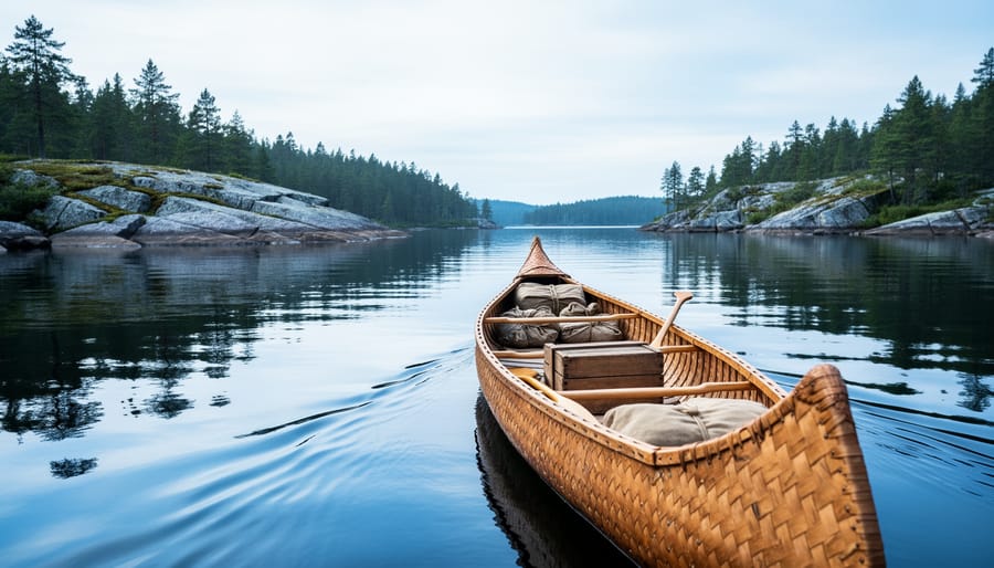
Ontario’s historic trade routes created a vast network of waterways and overland paths that powered the fur trade and early settlement from the 1600s through the 1800s, stretching from the Great Lakes deep into the northern wilderness. These routes, pioneered by Indigenous peoples and later adopted by French voyageurs and British traders, form the backbone of some of Ontario’s most scenic paddling destinations and hiking trails you can explore today.
The geography tells the story. Major arteries like the Ottawa River, French River, and the chain of lakes connecting Georgian Bay to Lake Nipissing carried birchbark canoes laden with beaver pelts, copper goods, and supplies. Shorter portage trails linked these waterways, creating an interconnected highway system long before roads existed. Towns like Thunder Bay, Sault Ste. Marie, and Kingston grew at strategic junctions where traders paused to rest, repair, and resupply.
What makes these routes special for modern adventurers is their dual identity. You’re not just paddling a beautiful Canadian Shield lake or hiking through old-growth forest. You’re retracing the exact paths where voyageurs sang paddling songs at dawn, where Indigenous guides knew every rapid and portage by heart, and where entire economies moved at the pace of human muscle and paddle stroke.
Many of these historic corridors now flow through provincial and national parks, complete with backcountry campsites, interpretive signage, and well-maintained portages. Others pass through heritage towns where you can visit reconstructed trading posts and museums between your outdoor adventures. The challenge isn’t finding these routes, but choosing which one to tackle first. Whether you have a weekend or a month, the map of Ontario’s trade routes offers a rare chance to blend serious outdoor exploration with tangible connections to the past.
Understanding Ontario’s Historic Trade Route Network
Long before European contact, Ontario’s landscape was already crisscrossed by sophisticated travel networks. Indigenous peoples had spent thousands of years establishing routes that followed the logic of the land, connecting watersheds through strategic portages, linking seasonal hunting grounds to fishing sites, and creating trade corridors that spanned the continent. These weren’t random paths but carefully maintained trails where birchbark canoes could navigate inland waters and where walking routes took advantage of high ground and natural passes through the forest.
The arrival of French fur traders in the 1600s didn’t create new routes; it intensified the use of existing ones. Coureurs des bois and voyageurs relied entirely on Indigenous knowledge, paddling the same water corridors and carrying their canoes over the same portage trails that had been used for generations. The Ottawa River became the superhighway of the fur trade, moving beaver pelts eastward and European trade goods, metal tools, textiles, firearms, westward into the interior. Georgian Bay and the north shore of Lake Ontario served as critical connectors, while the Trent system provided access deep into the interior hunting territories.
By the late 1700s and early 1800s, the pattern shifted again. British colonial authorities began surveying formal roads to support agricultural settlement and military movement. These often followed or paralleled the old trails, Yonge Street traced an Indigenous path northward from Lake Ontario, while Kingston Road connected early lakeside settlements. The difference was permanence: corduroy logs over swamps, cleared rights-of-way, and eventually gravel surfaces that allowed wheeled transport. Goods changed too. Instead of furs and trade goods, these routes now carried lumber, grain, livestock, and settlers’ household possessions. The same geographic logic remained, water crossings, high ground, connections between lakes, but the scale and purpose had transformed from continental Indigenous trade networks into the infrastructure of colonial expansion.
Major Trade Routes You Can Still Explore Today
The Great Lakes Water Routes
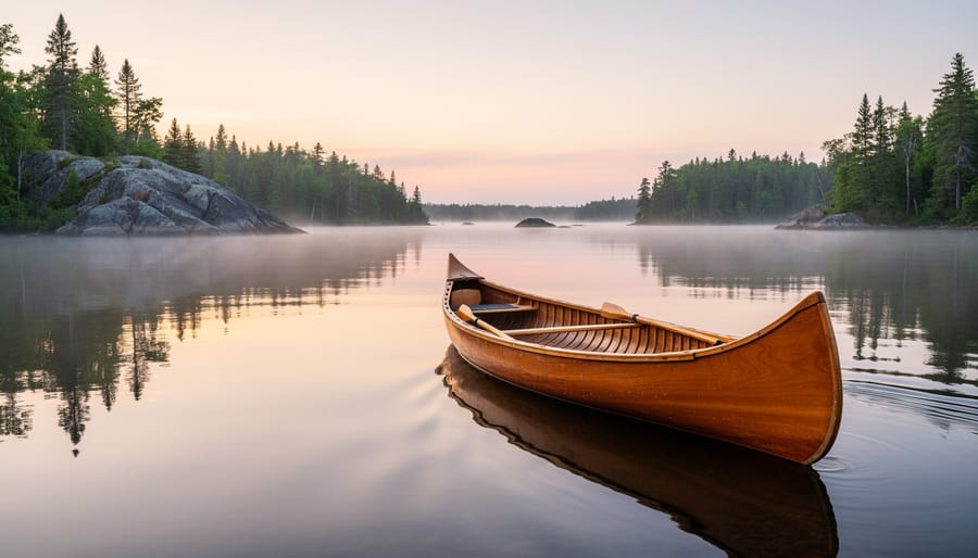
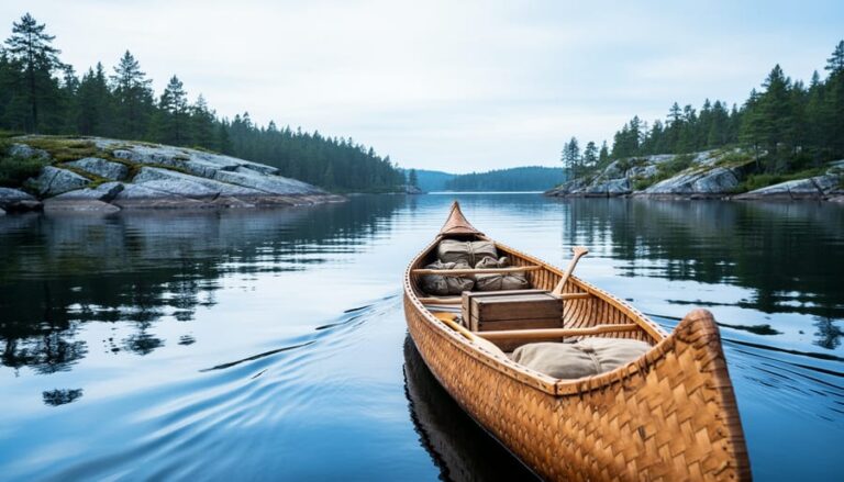
The Great Lakes and their connecting waterways formed the backbone of Ontario’s trade network for thousands of years. Long before European contact, Indigenous peoples developed sophisticated canoe routes linking Georgian Bay to Lake Ontario through river systems and carefully mapped portages. When French fur traders arrived in the 1600s, they adopted these same pathways, recognizing that water transport was the only practical way to move heavy loads of pelts and trade goods across the rugged Canadian Shield.
The Ottawa River corridor served as the main highway from Montreal into the interior, with dozens of Ottawa River portage points at rapids and falls where voyageurs would carry their birchbark canoes and cargo overland. Some portages stretched several kilometers, brutal work, but faster than any alternative. From the Ottawa, traders branched west through the Mattawa River and Lake Nipissing into Georgian Bay, or south through the Rideau lakes toward Lake Ontario.
The Lake Ontario shoreline itself became a critical route for colonial settlement, with small harbours and creek mouths serving as waypoints where traders could shelter from storms and replenish supplies. These natural harbours, at present-day Toronto, Kingston, and Port Hope, grew into permanent settlements precisely because of their strategic location along the water route.
Georgian Bay’s eastern shore was particularly crucial, with the French River serving as the gateway between Lake Huron and the inland route system. Today you can paddle these exact channels, passing through the same granite passages that supported centuries of commerce, and camp on the smooth rock islands where traders once stopped for the night.
The Trent-Severn and Rideau Corridors
The Trent-Severn and Rideau waterways trace pathways that Indigenous peoples traveled for thousands of years before European contact. When Samuel de Champlain paddled these routes, guided by Huron companions, in the early 1600s, he followed established portage networks connecting Lake Ontario to Georgian Bay and the Ottawa River to Lake Ontario. The modern canal systems simply formalized what canoeists already knew: these were the natural corridors through the landscape.
The Trent-Severn Waterway connects Lake Ontario at Trenton to Georgian Bay at Port Severn, following a chain of lakes and rivers with Indigenous roots in 1615 when Champlain’s expedition used this route. Today’s 386-kilometer system includes 44 locks, but between them you’ll paddle the same lakes where fur traders once camped. The Rideau Canal, running 202 kilometers from Ottawa to Kingston, similarly follows ancient travel routes along the Rideau and Cataraqui rivers.
Both systems offer exceptional opportunities for modern exploration. Boaters can cruise the entire length, stopping at historic lockstations where interpretive displays explain the routes’ evolution. Hikers will find trails at many locks and conservation areas along the corridors. The Rideau Trail follows much of the canal’s eastern shore for 387 kilometers, passing through forests where portage paths once cut between waterways. Launch your canoe at Peterborough or paddle the Big Rideau Lake to experience these routes as travelers did centuries ago, just with modern conveniences at your disposal.
Overland Trails and the Beginning of Roads

The transition from footpath to roadway tells the story of Ontario’s permanent settlement. Indigenous trails, worn smooth by centuries of travel between seasonal camps and trading sites, became the templates for the province’s first colonial roads. Governor Simcoe recognized what worked, routes chosen for their natural advantages, avoiding swamps, crossing rivers at the shallowest points, following high ground.
Yonge Street stands as the most dramatic example. Opened in 1796, it followed an existing trail from Lake Ontario northward toward Lake Simcoe, connecting water routes and opening land for settlement. Today’s Yonge Street still traces this original alignment for much of its length, though modern development obscures the forest corridor it once cut through. Look for heritage plaques at key intersections, particularly near Holland Landing where the road met the lake.
Kingston Road evolved from the Lakeshore Trail, an Indigenous pathway hugging Lake Ontario’s north shore. Walking any preserved section near the Scarborough Bluffs, you’ll notice how the route maintained sight of the water, crucial for orientation before standardized surveying. The road connected early military posts and became the main eastern highway into Upper Canada.
The Danforth, named for Asa Danforth who improved it in 1799, pushed eastward from York using existing trail networks. Stone mile markers occasionally survive in front yards and park corners, often unnoticed beside modern sidewalks.
To trace these routes authentically, seek out the oldest continuous sections, often preserved in ravine crossings where modern road-building avoided complications. Heritage conservation districts frequently protect streetscapes along original alignments. County and township historical societies maintain detailed records of route evolution, essential for distinguishing authentic pathways from later developments that simply borrowed historic names.
Northern Routes and the Canadian Shield
The rugged terrain of the Canadian Shield forced traders to develop intricate canoe networks that wound through lakes, rivers, and short portages, a system so efficient that modern paddlers still follow the same routes centuries later. These northern pathways connected Montreal to the western fur trade posts, carrying voyageurs and their cargo through what are now some of Ontario’s most beloved wilderness parks.
Algonquin Provincial Park sits directly on major fur trade corridors. The Petawawa River route ran east-west through the park, while the Tim River and Amable du Fond River systems linked to Ottawa River access points. Today’s backcountry canoe routes in Algonquin trace these historic passages almost exactly, and you’ll find portages worn smooth by generations of travelers. The park’s East Gate area particularly reveals trade route geography, look for interpretive signs explaining how voyageurs navigated this exact watershed.
Further north, Temagami’s interconnected lakes formed critical links in the northern trade network. The Lady Evelyn River system and Cross Lake routes provided passages between the Ottawa River drainage and northern Ontario’s interior. The region’s old-growth pines served as landmarks for navigation, and some of these same giants still tower over portage landings.
Quetico Provincial Park in northwestern Ontario represents the western reaches of Ontario’s Shield routes. Its border lakes connected to Lake Superior and the route west to Rainy Lake. Unlike Algonquin’s more accessible routes, Quetico demands serious wilderness skills, precisely what made it such a formidable yet essential trade corridor. Paddle these waters and you’re following voyageur paths that linked the Great Lakes to the prairies beyond.
Market Towns That Grew Along the Routes
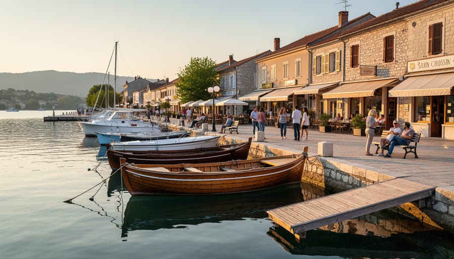
Kingston emerged at the meeting point of Lake Ontario, the St. Lawrence River, and the Rideau Canal system, making it the single most strategic trade hub in Upper Canada. By the early 1800s, the town controlled access to three major water routes, and merchants here could move goods between Montreal, the upper Great Lakes, and the newly settled interior. Today’s visitors find limestone warehouses along the waterfront that once stored furs, timber, and grain awaiting shipment. The Marine Museum of the Great Lakes occupies a working dry dock where shipwrights built vessels for both trade and War of 1812 defense. Walk the waterfront pathway to see how Kingston’s entire downtown faces the water routes that built it.
Prescott developed where the St. Lawrence narrows to its most navigable channel, forcing all river traffic past this crossing point. Fort Wellington, constructed to defend this commercial chokepoint, now demonstrates how trade routes created military targets. The fort’s restored blockhouse overlooks the exact water passage that carried millions of pounds of goods between the colonies. Local guides explain how customs officers stationed here collected revenue from virtually every trading vessel heading west.
Perth sits at the junction of the Rideau waterway and overland routes from Kingston, positioned to serve both the canal trade and settlers moving into the Lanark highlands. The town square retains its 1820s layout designed around a central market where farmers met merchants arriving by boat. Stone buildings around the square once housed general stores stocked with imported goods hauled up from Montreal.
| Market Town | Route Connection | Trade-Era Attractions | Visitor Activities |
|---|---|---|---|
| Kingston | Lake Ontario, St. Lawrence, Rideau Canal junction | Waterfront warehouses, Marine Museum, Fort Henry | Harbor walk, museum tours, fort demonstrations |
| Prescott | St. Lawrence narrows crossing | Fort Wellington, historic customs house | Fort tours, river views, heritage district walk |
| Perth | Rideau system and Lanark overland trails | 1820s market square, stone merchant buildings | Architecture walking tour, downtown heritage sites |
| Morrisburg | St. Lawrence River villages (pre-Seaway) | Upper Canada Village reconstruction | Living history interpretation, canal locks |
Morrisburg represents a unique case where the original market villages along the St. Lawrence were flooded by the Seaway project in the 1950s. Upper Canada Village recreates these lost communities, showing exactly how riverside market towns functioned during the canal trade era. The reconstructed village includes working mills, a general store stocked with period goods, and interpreters demonstrating crafts that supplied the trade networks.
Chatham developed where Indigenous trails met the Thames River, creating a natural gathering point that European traders quickly recognized. The town became a provisioning center for fur brigades heading to the upper Great Lakes, and later served settlers moving into southwestern Ontario. Several buildings from the 1840s trade period still stand along King Street, and local museums document both the fur trade connections and the Battle of Thames that demonstrated the route’s military importance.
Planning Your Own Historic Route Adventure
Start by choosing your route type based on your skills and available time. A weekend canoe trip retracing a single portage between lakes offers a tangible connection to voyageur travel, while a day spent driving the old Kingston Road with stops at historic sites works for families or those with limited paddling experience.
Research is essential. Provincial archives, local historical societies, and libraries hold original survey maps showing trail locations before road construction. Compare these with modern topographic maps to identify where old routes survive as hiking trails, forgotten road allowances, or waterways that haven’t changed. Many conservation authorities maintain trail guides that note historic significance along paths.
Look for physical evidence as you travel. Weathered blazes on old-growth trees, stone foundations of trading posts, remnants of corduroy roads in wetlands, and worn portage paths around rapids all tell stories. Near settlements, watch for early taverns, mills at river crossings, and heritage farms that once provisioned travelers.
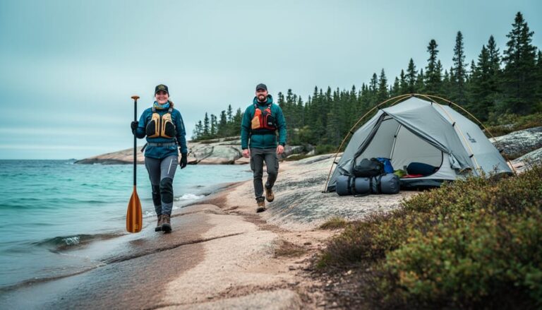
Pack appropriately for remote sections. Northern canoe routes following fur trade paths require backcountry camping gear, water filtration, and navigation skills. Cell coverage is unreliable, so carry paper maps and a compass. For road-based exploration, download offline maps and note that some historic routes now pass through private property requiring permission.
Practice responsible exploration. Stay on designated trails and waterways, camp only in approved areas, and never disturb archaeological features or remove artifacts. If you discover unmarked historic sites, photograph and report locations to local heritage organizations rather than publicizing exact coordinates that might encourage looting.
Frequently Asked Questions
Can you hike original trade route trails or are they all paved roads now?
Many water routes remain navigable by canoe much as they were centuries ago, particularly in provincial parks and protected areas. Land routes vary: some sections like portages in Algonquin retain their wilderness character, while others like Yonge Street are now busy modern roads with only occasional historic markers indicating their origins.
What’s the best season to explore historic trade routes?
Late spring through fall offers the most accessible conditions for both paddling and hiking historic routes. Paddlers should target May through September for warmer water and reliable water levels, while hikers can explore land routes from April through October when trails are clear and interpretive sites are typically open.
Where can I camp along historic trade routes?
Provincial parks along major routes offer designated backcountry campsites that often sit at historic portages or river junctions. The Trent-Severn and Rideau systems have lockside camping facilities, and many conservation areas along former overland routes provide modern campgrounds with historical interpretation nearby.
How do I research specific historic routes before visiting?
Start with Ontario Parks websites for canoe route maps that often include historical notes, and check local historical societies in market towns for walking tour guides. The Ontario Heritage Trust maintains databases of historic sites, and many routes intersect with War of 1812 sites that provide additional context about early transportation needs.
The key to meaningful exploration is matching your interests and skill level to the right route type. Water routes demand paddling experience and proper safety equipment, while walking historic roads through towns requires less preparation but offers different rewards. Most visitors find combining both approaches gives the fullest picture of how goods and people actually moved through the landscape.




+ There are no comments
Add yours