
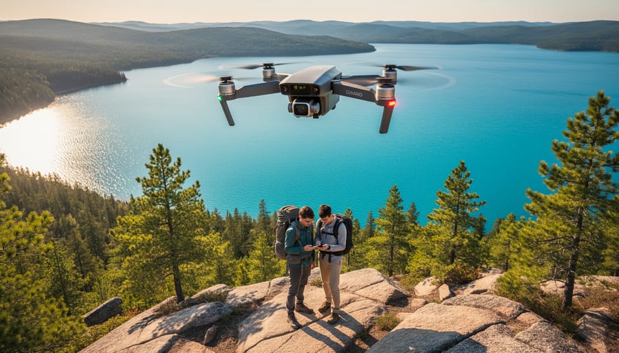
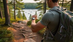
Picture this: You’re standing at a trailhead in Algonquin Provincial Park, smartphone in hand, watching a tiny satellite icon confirm your exact location within meters. That’s GPS technology working with drone-mapped terrain to transform how you explore Ontario’s wilderness. Gone are the days of solely relying on paper maps and trail markers—today’s park visitors have access to precision navigation tools that make adventures safer, more efficient, and surprisingly more immersive.
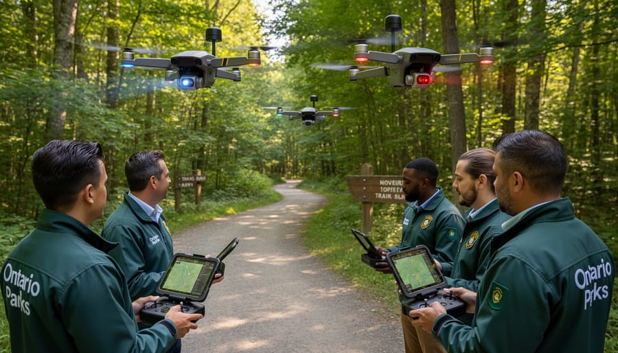
Drones equipped with GPS receivers have revolutionized how parks create accurate trail maps and monitor remote areas. These flying cameras capture high-resolution images that become the digital maps on your phone, showing every switchback, viewpoint, and water source with remarkable accuracy. When you open a park navigation app, you’re often looking at drone-surveyed data processed into user-friendly formats.
The real magic happens when your device’s GPS connects with this drone-collected information. You get real-time positioning on trails, estimated distances to destinations, and even terrain difficulty ratings based on actual topography. Parks like Killarney and Bruce Peninsula now offer downloadable GPS-enabled maps that work offline, meaning you stay oriented even without cell service.
This technology partnership does more than prevent getting lost. It helps parks manage visitor flow to protect sensitive ecosystems, guides you to less-crowded trails, and even assists search-and-rescue teams when emergencies arise. For anyone planning an Ontario park adventure, understanding how drones and GPS work together opens up a whole new level of outdoor confidence and exploration possibilities.
What Drone-Assisted Navigation Actually Means for Park Visitors
The Tech Behind the Magic (Don’t Worry, It’s Simple)
Here’s the thing – you don’t need to be a tech wizard to understand how GPS drones help you explore parks better. Think of it like a really smart bird’s-eye photographer combined with your phone’s map app.
These drones fly over parks equipped with GPS receivers that pinpoint their exact location as they capture images and data. The GPS chip in the drone talks to satellites orbiting Earth, creating incredibly accurate maps showing trails, viewpoints, and facilities down to the meter. As the drone flies its pre-programmed route, it photographs everything below while recording precise coordinates.
The magic happens when park services process this information and feed it into visitor apps or websites. When you open your park app at Algonquin or Killarney, you’re seeing real, recent aerial imagery merged with GPS data – those trail markers, rest areas, and scenic lookouts are exactly where the drone recorded them.
Some Ontario parks now offer live trail condition updates through these systems. The drone spots a fallen tree blocking Trail 5? That information appears on your app within hours, helping you plan alternative routes before you even leave home. It’s technology working quietly behind the scenes to make your outdoor adventure smoother and safer.
From Overhead Views to Your Smartphone
The real magic happens when all that aerial data lands right in your pocket. Park managers process drone imagery through specialized software that creates detailed topographic maps, identifies trail conditions, and spots potential hazards like fallen trees or washouts. This information then gets pushed to park websites and mobile apps, often updated weekly during peak season.
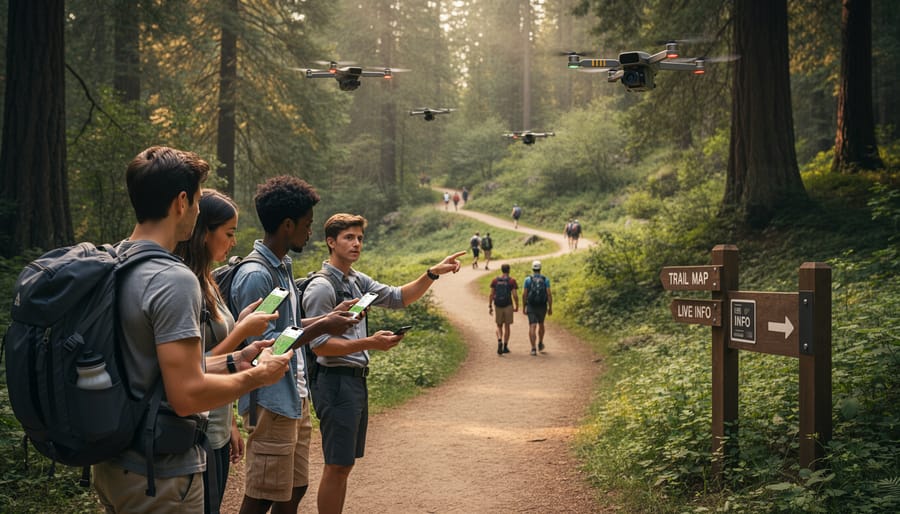
You’ll find this translates into super practical tools. Many Ontario parks now offer downloadable trail maps showing real-time conditions, complete with colour-coded difficulty ratings based on recent drone surveys. Some parks integrate this data with AR navigation apps that overlay trail information onto your phone’s camera view as you hike.
Here’s an insider tip: check park apps the morning of your visit. Drone surveys often happen midweek, so updates typically appear Thursday or Friday. You’ll get the freshest intel on muddy sections, wildlife sightings, and even parking availability at popular trailheads, helping you plan smarter adventures.
Real Ways Drones Are Helping You Navigate Ontario Parks Right Now
Never Miss That Hidden Waterfall Again
You know that frustrating feeling when you’re hiking through a park, certain you’ve read about an incredible waterfall or scenic lookout nearby, but you just can’t find it? GPS-enabled drones are changing this experience entirely. Park management teams now use aerial mapping technology to document and precisely locate hidden gems that might otherwise stay off the beaten path.
When drones survey parks from above, they create detailed topographical maps that show everything from tucked-away cascade trails to rock formations with spectacular valley views. These mapped coordinates get added to park navigation apps, meaning you can now pinpoint that secluded beach on Lake Superior or find the exact viewpoint where the autumn colours look most spectacular. I’ve personally used drone-mapped coordinates to discover a quiet riverside spot in Frontenac Provincial Park that wasn’t on any traditional trail map.
Here’s an insider tip: check if your destination park has a recent drone survey available. Many Ontario parks now include drone-captured locations in their digital trail guides, complete with GPS coordinates you can plug right into your phone. This technology particularly shines during spring when high water creates temporary waterfalls that traditional maps simply can’t keep up with. The result? You spend less time wandering in circles and more time actually enjoying those magical moments nature has to offer.
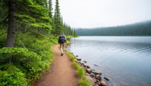
Real-Time Trail Conditions at Your Fingertips
Picture this: you’re planning a weekend hike at Algonquin Provincial Park, but you’re wondering if that spring storm washed out the Highland Backpacking Trail. Instead of driving three hours to find out, you simply check your park app for a drone-captured update from yesterday afternoon. That’s the beauty of real-time trail monitoring happening across Ontario parks right now.
Park management teams are increasingly deploying drones to scout conditions before you even lace up your boots. At Bruce Peninsula National Park, drones regularly check the Grotto Trail for erosion and overcrowding, helping rangers direct visitors to less-impacted areas. After heavy rains, aerial footage can identify washouts or fallen trees within hours, allowing parks to post accurate trail closures and suggest alternatives.
Wildlife monitoring benefits hikers too. Drones equipped with thermal imaging have tracked bear activity near popular camping areas in Killarney Provincial Park, giving staff advance notice to issue warnings. Here’s an insider tip: many Ontario parks now post drone-gathered updates on their social media channels every Friday afternoon, perfect timing for weekend trip planning. Some parks even share stunning aerial footage showing current fall colours or snow conditions, so you know exactly what to expect before you arrive.
Finding Your Way Back When the Trail Gets Confusing
Getting turned around on a trail happens to even experienced hikers, but modern drone-assisted GPS systems are changing how quickly help arrives. When you’re exploring Ontario’s vast backcountry and lose your bearings, emergency response teams can now deploy drones equipped with thermal imaging and GPS tracking to locate you within minutes rather than hours. These aerial search systems work alongside smart safety technology to create a comprehensive safety net.
Many Ontario parks now partner with search and rescue teams who use drones to pinpoint distress signals from your phone or GPS device. The drones relay your exact coordinates to ground crews, making rescue operations significantly faster and safer for everyone involved. Some parks even offer rental GPS beacons that communicate directly with drone systems.
Here’s an insider tip: before heading into remote areas, download offline maps and register your hiking plan with park offices. This simple step helps drone operators narrow their search area if needed. Consider carrying a brightly colored tarp or whistle, which makes you more visible to aerial searches. Remember, this technology works best when you stay put once you realize you’re lost, allowing the GPS signal to remain consistent for tracking purposes.
The Visitor Services You Didn’t Know Drones Were Providing
Spotting Wildlife Without Disturbing Them
Picture this: you’re hiking through Algonquin Park, hoping to spot a moose, but you’re not sure which trails offer the best chances today. Modern drone surveillance and GPS mapping are changing wildlife viewing by helping park managers share real-time animal locations with visitors while keeping a safe, respectful distance from the animals themselves.
Some Ontario parks now use drones equipped with wildlife monitoring technology to track animal movements without human interference. This data gets integrated into visitor apps, showing you where bears, elk, or waterfowl have recently been spotted. Instead of wandering aimlessly or accidentally stumbling upon animals and startling them, you can plan your route strategically.
Here’s an insider tip: check your park’s mobile app before heading out each morning. Many parks update wildlife activity zones overnight based on drone surveys. This helps you maximize your chances of sightings while giving sensitive species the space they need. Remember, observing from a distance isn’t just courteous—it’s essential for animal welfare and ensures these magnificent creatures remain comfortable in their natural habitat for future generations to enjoy.
Beating the Crowds at Popular Spots
We’ve all experienced that sinking feeling when you arrive at a stunning lookout point only to find it packed with other visitors. Here’s where drone technology becomes your secret weapon for trip planning. Several Ontario parks now use drones equipped with GPS to monitor visitor density throughout the day, and they’re sharing this data to help you beat the crowds.
Algonquin Park has been pioneering this approach, using real-time aerial monitoring to track which trails and canoe routes are busiest. Check their website or visitor apps before you head out—you’ll see current crowd levels and predicted busy times for popular spots like Lookout Trail or Canisbay Lake. I’ve used this system to shift my hiking start time by just two hours and had entire trails practically to myself.
The eco-friendly bonus? Spreading visitors more evenly across parks reduces trail erosion and wildlife disturbance. You’re not just getting a better experience—you’re helping protect these spaces. Some parks even send alerts when alternative, equally beautiful but less-known locations have low visitor numbers, introducing you to hidden gems you might otherwise miss.
Virtual Park Tours Before You Even Arrive
Gone are the days of arriving at a park entrance with nothing but a paper map and hope. Many Ontario parks now offer virtual drone tours on their websites, giving you a bird’s-eye preview of what awaits. Before you even pack your hiking boots, you can explore trail conditions, scout potential campsites near water features, and gauge difficulty levels from an aerial perspective.
I discovered this feature while planning a family trip and was able to identify which campsite had the most shade—crucial for summer camping with kids. The drone footage showed me exactly where the swimming area was in relation to different loops, saving us from choosing a site that would’ve meant a long walk with beach gear.
These virtual tours are especially helpful for accessibility planning. You can spot steep sections, narrow pathways, or areas that might be challenging for young children or those with mobility concerns, ensuring everyone in your group finds suitable adventures.
Insider Tips: Making the Most of Drone-Enhanced Park Services
Apps and Tools Worth Downloading Before Your Trip
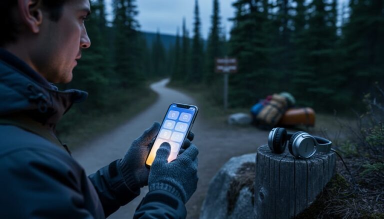
Before heading into Ontario’s parks, I recommend downloading a few game-changing apps that’ll enhance your navigation experience. Start with Gaia GPS, which offers detailed topographic maps and integrates beautifully with drone-surveyed trail data for several Ontario parks. The offline map feature is brilliant when you’re beyond cell service—I’ve used it countless times in Algonquin’s backcountry.
AllTrails is another must-have, featuring user-uploaded GPS tracks and recent trail conditions. Many Ontario hikers now supplement their reviews with drone footage perspectives, giving you a bird’s-eye preview before you set out. For photography enthusiasts, the UAV Forecast app helps you check wind conditions and no-fly zones, ensuring your own drone adventures stay legal and safe.
Park-specific apps like Ontario Parks’ official app now incorporate GPS-enhanced trail maps for participating locations. Pair these with AI-powered travel tools for route planning that considers your fitness level and interests. Pro tip: download all maps and updates while you’re still on WiFi at home—your future self will thank you when you’re deep in the wilderness with patchy connectivity.
What to Ask Park Staff About Drone Services
When you stop by a park’s visitor center, don’t be shy about asking how drone technology can enhance your visit. Start with the basics: “Do you offer drone-assisted trail maps or virtual previews of hiking routes?” Many parks now provide GPS coordinates gathered through drone surveys that pinpoint scenic lookouts, wildlife viewing areas, and photo-worthy spots you might otherwise miss.
Ask if they have recent drone footage available—some parks maintain digital displays or QR codes linking to aerial videos that help you visualize trail difficulty and terrain before you head out. This insider tip can save you from choosing a route that’s beyond your comfort level or missing one that’s absolutely perfect for your abilities.
It’s worth inquiring about seasonal updates too. “When was your drone mapping last refreshed?” gives you confidence that trail conditions, water levels, and accessibility information are current. If you’re environmentally conscious, ask about their drone protocols: “How do you minimize disturbance to wildlife during surveys?” Responsible parks typically conduct flights during off-peak hours and avoid nesting seasons.
Finally, request information about any drone-restricted zones within the park. Understanding these boundaries helps you appreciate how parks balance technological benefits with conservation priorities, ensuring these natural spaces remain pristine for future visitors.
The Eco-Friendly Side of Drone Technology in Parks
Protecting Sensitive Areas by Keeping Visitors on Track
Here’s something I learned during a muddy spring hike at Algonquin Provincial Park: when you can’t find the trail, you end up trampling wildflowers and creating new erosion paths without meaning to. GPS-guided navigation helps prevent exactly this kind of accidental damage. When park apps show you precisely where the marked trail runs, you’re far less likely to wander into sensitive wetland areas or step on delicate moss beds that took decades to establish.
Think of it as invisible guardrails for the wilderness. Many Ontario parks now use GPS mapping to highlight which areas need extra protection, like nesting grounds during bird migration season or rare plant habitats. The technology gently nudges you back on course before you accidentally cause harm. I’ve noticed that trails equipped with GPS waypoints show significantly less widening and soil compaction compared to unmarked routes.
Insider tip: Download your park’s GPS trail map before you arrive. When you can see exactly where you are relative to designated paths, you’ll naturally stick to established routes, keeping both yourself safe and Ontario’s precious ecosystems intact for future generations to enjoy.
Supporting Conservation Through Better Data
Here’s something exciting: the data collected from drone monitoring isn’t just creating better trail maps—it’s actually helping Ontario’s parks protect the ecosystems you love to explore. Park managers use aerial imagery to track wildlife corridors, identify areas where vegetation needs restoration, and spot erosion problems before they become major issues. This means when you’re planning your visit, you can feel good knowing those digital maps are built on information that’s actively supporting conservation efforts.
For example, thermal imaging drones can locate sensitive nesting sites without disturbing the wildlife, allowing parks to temporarily reroute trails during breeding seasons. This keeps both animals and visitors safer while maintaining access to stunning natural areas. The GPS data also helps managers understand which trails get the most foot traffic, so they can focus maintenance resources where they’re needed most and prevent overuse in fragile zones. As a visitor, you benefit from well-maintained trails and healthier ecosystems, all thanks to technology working quietly behind the scenes to balance recreation with preservation.
So there you have it—drones and GPS technology aren’t just gadgets for tech enthusiasts anymore. They’re practical tools that can genuinely transform how you explore Ontario’s incredible parks, making your adventures safer, more efficient, and honestly, way more memorable.
Here’s the thing I’ve learned from my own park experiences: technology doesn’t diminish the authentic outdoor experience when used thoughtfully. That GPS tracker on your phone doesn’t replace the thrill of discovering a hidden waterfall—it just helps ensure you make it back to tell the story. Those drone regulations aren’t buzzkills; they’re protecting the wilderness we all came to enjoy in the first place.
Ready to give it a try? Start simple on your next Ontario park visit. Download the park’s official app before you head out (when you still have cell service!). Charge up your devices and bring a portable battery pack. If you’re planning to bring a drone, spend an evening reviewing Transport Canada’s regulations and checking the park’s specific policies. Remember, the goal is to enhance your connection with nature, not replace it with screen time.
The trails are waiting, and now you’ve got the tools to explore them with confidence. Whether you’re navigating Algonquin’s backcountry or capturing sunset at Killbear from above, these technologies are your invitation to go further, explore deeper, and come home with stories worth sharing. See you out there!


+ There are no comments
Add yours