
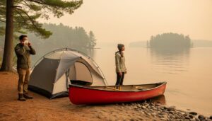
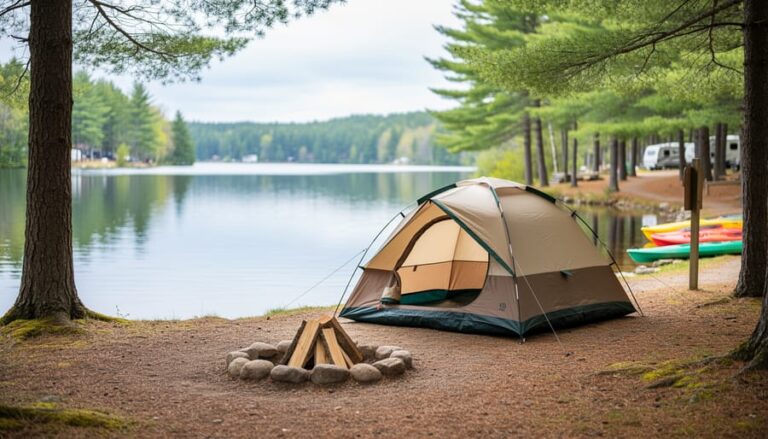
Picture this: You’ve mapped out the perfect weekend getaway to Algonquin Park, loaded up the car with camping gear, and you’re ready to hit the road. Then you discover the public access road to your chosen destination is closed, and suddenly your carefully laid plans unravel. Sound familiar?
Public access roads are the arteries that connect you to Ontario’s stunning natural spaces, but they’re not your typical paved highways. These routes wind through remote wilderness areas, crossing streams, navigating rugged terrain, and exposing themselves to the full force of Ontario’s dramatic weather patterns. Unlike maintained park highways, public access roads often require seasonal closures for safety, environmental protection, or simply because spring thaw has turned them into impassable mud bogs.
Understanding how these roads work can save you hours of frustration and potentially rescue an entire trip. The good news? With a bit of insider knowledge, you’ll learn to check road conditions before you leave home, identify alternative routes when closures pop up, and time your visits when access is most reliable. Whether you’re planning a backcountry fishing expedition, heading to a remote trailhead, or accessing a cottage property, knowing the ins and outs of public access roads transforms you from a frustrated traveler into a prepared adventurer who navigates Ontario’s wilderness with confidence.
What Exactly Is a Public Access Road in Ontario Parks?
If you’ve ever looked at an Ontario Parks advisory and spotted the term “public access road,” you might have wondered what makes it different from any other road in the park. Here’s the thing: not all roads leading to or through provincial parks are actually owned by Ontario Parks.
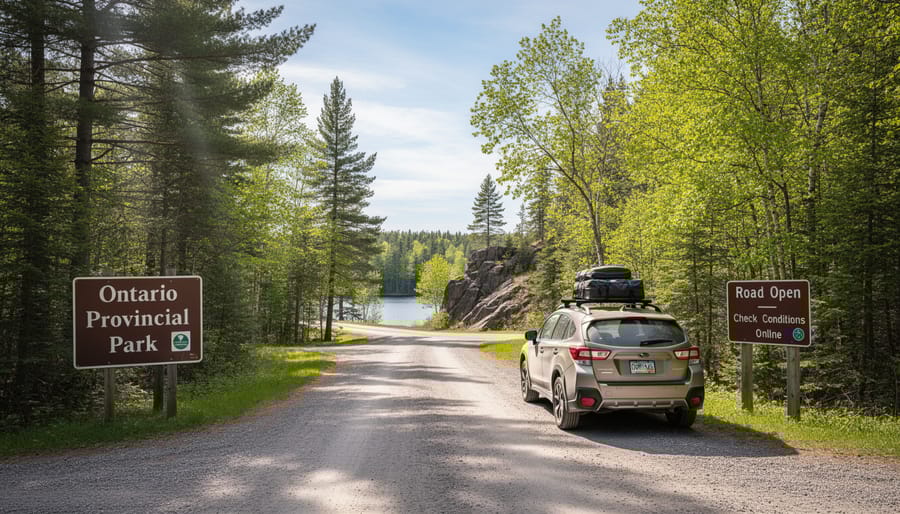
A public access road is typically a municipal or county road that happens to pass through or provide access to provincial parkland. Think of it like this: the park might own the trails, campsites, and visitor centres, but the road you drive on to get there? That often belongs to the local municipality. In Frontenac Provincial Park, for example, the main access road is actually maintained by the local township, not the park itself.
This distinction really matters when you’re planning your visit. Ontario Parks can’t fix potholes, clear fallen trees, or plow snow on roads they don’t own. If there’s a washout on a public access road, you’ll need to wait for the municipality to handle repairs, which might follow a different timeline than park maintenance. I learned this the hard way when planning a spring camping trip only to discover that while the park was technically open, the access road was still closed for seasonal maintenance by the county.
Regular park roads, on the other hand, are maintained directly by Ontario Parks staff and are included in park operation budgets and schedules. These roads typically open and close according to the park’s seasonal calendar.
Why does this matter for your trip? Because closure advisories for public access roads often come from different sources than park advisories. You might check the Ontario Parks website and see everything looks good, but the local municipality hasn’t yet announced their road is passable. Always check both the park’s official updates and local township websites, especially during shoulder seasons or after severe weather events.
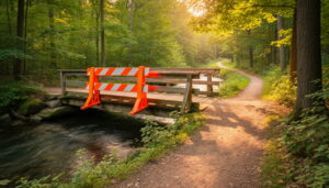
Why Roads, Bridges, and Gates Get Closed (And When to Expect It)
Seasonal Closures You Can Plan Around
Understanding seasonal road closures can save you from disappointment and help you time your visit perfectly. In Ontario parks, spring thaw typically wreaks havoc on public access roads from late March through early May. The freeze-thaw cycle creates deep ruts and washouts that make roads impassable, and parks often close them to prevent further damage.
Here’s an insider tip: if you’re planning an early spring visit, call ahead in mid-April to check specific road conditions. Many parks reopen access roads by Victoria Day weekend once maintenance crews complete repairs.
Winter closures run from late November through early April in most parks, though timing varies by region. Northern Ontario parks close earlier and open later than their southern counterparts.
My advice? Plan summer visits between June and September for guaranteed road access. If you’re keen on shoulder seasons, build flexibility into your itinerary and have backup park options ready. The parks website updates closure schedules annually by February, giving you plenty of time to adjust your plans around predictable seasonal patterns.
Emergency and Unexpected Closures
Mother Nature doesn’t always follow a schedule, and sometimes public access roads close without much warning. I learned this the hard way during a spring camping trip when an overnight storm washed out a culvert on Arkon Road, forcing us to take a two-hour detour. These unexpected closures happen more often than you’d think.
Sudden closures typically occur due to severe weather events like flash flooding, heavy snowfall, or fallen trees blocking the roadway. Bridge safety inspections can also trigger immediate closures if structural concerns are discovered. Wildlife activity is another surprising cause—during spring, roads through bear habitat may close temporarily if a mother bear and cubs are spotted near the roadway, ensuring both visitor and animal safety.
So how do you stay in the loop? Ontario Parks uses multiple communication channels. Their website features real-time advisories that are updated as situations develop. Many parks also post alerts on their social media pages, so following your destination park on Facebook or Twitter can give you instant notifications. Some regions even send out email alerts to subscribers.
Here’s an insider tip: before leaving home, call the park office directly. Staff can provide the most current information about road conditions and suggest alternative routes. This is especially important for remote parks where trail closures and road issues might not be immediately posted online.
Understanding weather-related closures helps you plan backup options and avoid disappointment at the park gate.
How to Stay Ahead of Access Road Advisories
Best Resources for Real-Time Updates
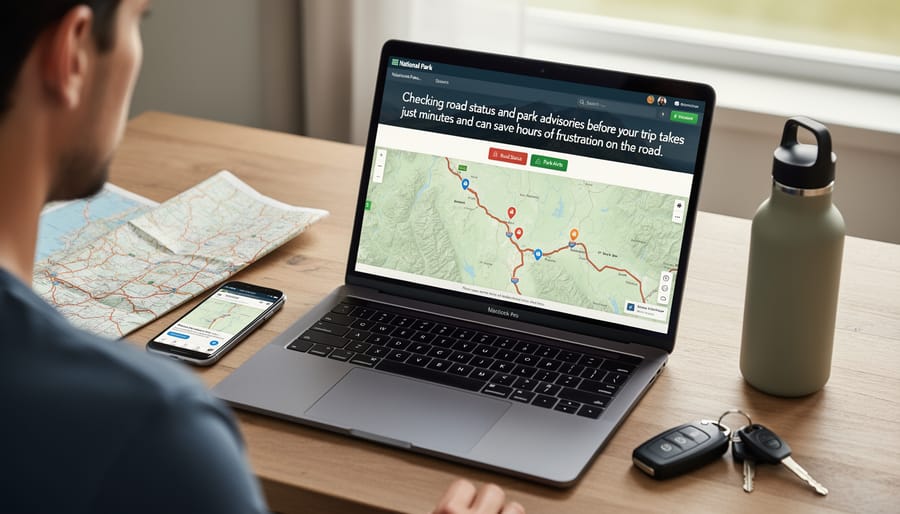
I’ve learned the hard way that bookmarking the right resources before heading into Ontario’s backcountry can save you from driving hours only to find your route closed. For Frontenac Provincial Park specifically, the Ontario Parks official website should be your first stop—they maintain real-time advisories at ontarioparks.com/alerts. Bookmark this page and check it 24 hours before departure, as conditions can change quickly, especially during spring thaw or after heavy storms.
Here’s an insider tip: sign up for email notifications through your Ontario Parks account. You’ll receive updates about closures affecting parks you’ve favorited, giving you advance warning to adjust your plans. The interactive park map on the Frontenac Provincial Park page shows which access roads are currently open, incredibly helpful when planning alternative routes.
For broader updates across Ontario’s park system, follow Ontario Parks on Twitter and Facebook—they’re surprisingly responsive and post real-time alerts during weather events. I also recommend downloading the offline maps from their website before losing cell service, since many access roads pass through areas with spotty coverage. Local outfitters near the park often share current conditions on their social media too, offering ground-level insights you won’t find on official channels.
What to Ask When You Call Ahead
When you’re calling ahead to check on public access road conditions, knowing what to ask can make all the difference between a smooth trip and an unexpected detour. Start with the basics: “Is the access road currently open?” Then dig deeper with questions like “Are there any rough patches or washouts I should know about?” and “What’s the road surface like—gravel, dirt, or paved?” This helps you gauge whether your vehicle can handle it.
Here’s an insider tip: always ask about recent weather impacts. A road might be technically open but challenging after heavy rain. Don’t forget to inquire about alternative routes by asking, “If this road closes while I’m visiting, what’s my backup option?” Park staff can share local knowledge about secondary access points that might not appear on standard maps.
I also recommend asking about gate hours if applicable, especially during shoulder seasons. Nothing’s worse than getting locked in—or out—because you didn’t know the gate closes at dusk. Finally, get a direct phone number for the specific park office. Cell service can be spotty, but having that number saved means you can call with updates if conditions change during your visit.
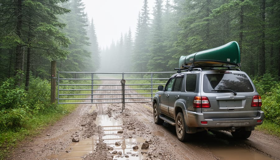
Your Backup Plan When Gates Are Closed
So you’ve arrived at your planned destination only to find a gate firmly closed across the public access road. Take a deep breath—this isn’t the end of your outdoor adventure, just a gentle nudge toward something different. Think of it as the universe giving you permission to explore somewhere new.
First things first: pull out your park map or smartphone and look for alternative access points. Many Ontario parks have multiple entry routes, and often a nearby trailhead or parking area can get you surprisingly close to your original destination. I once had to detour around a closed access road at Frontenac Provincial Park and ended up discovering a gorgeous shoreline spot I never would have found otherwise.
Chat with park staff or locals if possible—they’re goldmines of information about lesser-known gems in the area. That closed road might actually lead you to explore a neighboring conservation area or a charming small-town trail system you’d never considered.
Consider this your invitation to be spontaneous. Pack a picnic and visit a nearby lakefront park instead. Stop at a local farmers’ market. Find a quiet spot along a creek for wildlife watching. Some of my favorite outdoor memories came from completely unplanned detours.
Pro tip: Download offline maps before heading into areas with spotty cell service, so you can quickly pivot to Plan B without frustration. Keep a provincial park guidebook in your vehicle for instant inspiration.
Remember, flexibility is the secret ingredient to memorable adventures. That closed gate isn’t blocking your day—it’s redirecting you toward an experience you haven’t had yet. Embrace the detour with curiosity, and you might just stumble upon your new favorite spot.
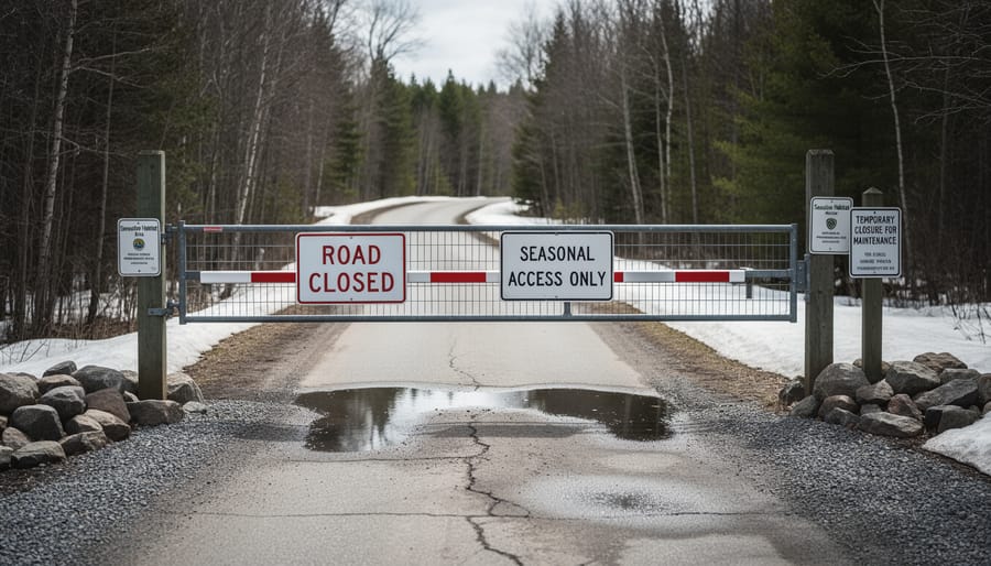
Respecting Closures: Why It Matters for Everyone
I’ll be honest with you – when you see a “Road Closed” sign, it’s easy to think, “Oh, it’s probably fine. I’ll just be quick.” But here’s the thing: those closures exist for really good reasons, and ignoring them affects way more than just you.
Let’s talk safety first. Road closures aren’t just bureaucratic caution – they often mean there’s genuine danger ahead. I’ve heard stories from park wardens about washed-out bridges, unstable shoulders ready to give way, and fallen trees blocking paths in ways you can’t see from a distance. One friend ignored a closure thinking the road “looked okay” and ended up stranded when her vehicle got stuck in mud that had completely undermined the roadbed. The rescue operation cost her thousands and put emergency responders at risk.
Then there’s the environmental piece. When roads close for wildlife corridors or sensitive breeding seasons, it’s because our presence genuinely disrupts crucial natural processes. Spring closures often protect nesting birds and emerging amphibians. Those tire tracks through a closed muddy road? They create erosion channels that take years to heal and can damage delicate ecosystems.
Here’s something most people don’t consider: liability. If you ignore closure signs and get injured or damage your vehicle, you’re likely on your own. Insurance companies and park authorities aren’t sympathetic to people who deliberately bypassed warnings.
The bigger picture matters too. Every time someone disrespects closures, it creates pressure to add more permanent restrictions. Park managers have actually told me that repeated violations lead to reduced access for everyone. By respecting these temporary closures, we’re collectively protecting our long-term freedom to explore these incredible natural spaces. Think of it as being part of a community that values both adventure and responsibility.
Now that you’ve got the inside scoop on public access roads, staying informed is easier than ever. A quick five-minute check of road advisories before you pack the car can save hours of frustration and turn a potential detour into an opportunity for adventure. Ontario’s parks are waiting for you, and knowing how to navigate access information means you’ll spend less time worrying and more time enjoying those stunning lakeside views and forest trails.
Here’s my personal insider tip: bookmark the Ontario parks advisory page on your phone and check it the morning of your trip, even if you looked earlier in the week. Weather changes fast, and road conditions change with it. I’ve learned this lesson the hard way more than once! But when you’re prepared, even unexpected closures become part of the story rather than a trip-ruiner.
So grab your gear, double-check those road statuses, and head out with confidence. Ontario’s natural spaces are incredibly accessible when you know where to look for information. Happy exploring, and remember to travel responsibly, leaving each beautiful spot just as pristine as you found it. The adventure is calling!


+ There are no comments
Add yours