

Download your local transit authority’s app and cross-reference it with AllTrails or provincial park websites to identify which trailheads sit within walking distance of bus or train stops. In Ontario, GO Transit reaches surprising wilderness destinations like the Bruce Trail access points and Rouge National Urban Park, while local systems in Ottawa, Toronto, and Hamilton connect directly to conservation areas most drivers don’t realize exist.
Check transit schedules for weekend and holiday service before you commit to a hike—many routes reduce frequency or stop running entirely on Sundays, leaving you stranded at a remote trailhead when you’re ready to head home. Set departure reminders on your phone for at least 30 minutes before the last bus to account for unexpected trail delays.
Pack a portable phone charger and screenshot your route maps, transit schedules, and trail information before leaving home. Cell service disappears quickly once you’re on the trail, and you’ll need those screenshots to navigate connections on your return journey.
Consider the environmental win you’re claiming by skipping the drive. Public transit eliminates trailhead parking challenges, reduces your carbon footprint, and often costs less than the gas you’d burn driving. You’ll arrive at the trail relaxed instead of road-stressed, and you can fully enjoy that post-hike exhaustion on the ride home without worrying about highway driving.
The combination of transit access and trail exploration opens up adventures you’d never attempt with a car, transforming your weekend hiking routine into genuine urban-to-wilderness expeditions.
Why Public Transit to Trailheads Changes Everything
Taking the bus or train to a trailhead might sound unconventional, but it’s honestly one of the best-kept secrets in Ontario hiking. Once you try it, you’ll wonder why you ever bothered circling crowded parking lots.
Let’s start with the obvious: it’s better for the planet. Every time you leave your car at home and hop on transit, you’re reducing carbon emissions and helping preserve the very wilderness you’re heading out to explore. It feels good knowing your adventure starts with a lighter environmental footprint.
Your wallet will thank you too. When you factor in gas, vehicle wear and tear, and parking fees at popular trails, transit fares suddenly look pretty appealing. Plus, you’ll never experience the frustration of arriving at a trailhead only to find every spot taken—those parking headaches simply disappear.
Here’s where it gets really exciting: one-way hikes. Instead of turning around and backtracking to your car, you can hike point-to-point, catch transit at the other end, and see twice as much scenery. This opens up entirely new route possibilities that most hikers never consider.
Transit access also democratizes the outdoors. Not everyone owns a car or has their license, especially newcomers to Ontario or younger adventurers. When trails are accessible by public transit, we’re inviting more people to experience the incredible natural spaces our province offers.
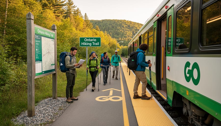
I’ll never forget my first GO Train trip to the Bruce Trail near Burlington. Watching the sunrise from the train window with my pack beside me, surrounded by other hikers comparing notes, felt like joining a community. We struck up conversations, shared trail snacks at the summit, and I made two hiking buddies I still adventure with today. That sense of camaraderie—that shared commitment to exploring sustainably—simply doesn’t happen in a solo car ride. Transit transforms your hike into something bigger than just the trail itself.
Understanding Ontario’s Transit-to-Trail Network
Greater Toronto Area Connections
Toronto’s transit network makes it surprisingly easy to trade the subway for woodland paths without ever touching your car keys. The TTC connects seamlessly with regional services, opening up thousands of acres of greenspace right from Union Station.
For Rouge Park adventures, hop on the GO Train Lakeshore East line to Rouge Hill Station—you’ll be steps from Canada’s first national urban park and its 50 kilometers of trails. The TTC’s 85 Sheppard East bus also drops hikers near the park’s northern entrances. Here’s an insider tip: visit midweek in spring when trilliums carpet the forest floor and you’ll practically have the trails to yourself.
The Humber Valley Trail system connects beautifully with transit too. Take the TTC subway to Old Mill Station and you’re immediately beside the Humber River Trail, where you can walk north through peaceful ravines all the way to the Kortright Centre. The 41 Keele bus provides access to multiple trailheads along the valley’s western edge.
Reaching the Niagara Escarpment from Toronto is equally straightforward. GO Transit’s Milton line brings you to trail access points along the Bruce Trail, particularly around Milton and Georgetown stations. The UP Express to Pearson connects with MiWay transit routes serving the Credit Valley trails.
Pro eco-tip: download the Transit app before heading out—it shows real-time connections between TTC, GO Transit, MiWay, and Brampton Transit, helping you plan seamless multi-system journeys while minimizing your carbon footprint.
Ottawa and Eastern Ontario Options
Ottawa’s OC Transpo system opens up wonderful opportunities for nature lovers wanting to explore without a car. Route 61 whisks you to several Greenbelt trailheads, including the popular Stony Swamp Conservation Area, where you can wander through peaceful forests and wetlands just minutes from downtown. I’ve found the morning buses less crowded, perfect for carrying hiking poles or backpacks.
For a cross-provincial adventure, hop on routes connecting to Gatineau Park in Quebec—you’ll discover over 165 kilometers of trails through the stunning Gatineau Hills. The park’s visitor center staff are incredibly helpful with transit timing advice. Here’s an insider tip: download the OC Transpo app before heading out, as rural route schedules can be less frequent, especially on weekends.
Eastern Ontario gems like Mer Bleue Bog are accessible via Route 30, offering boardwalk trails through a unique peatland ecosystem. Pack your reusable water bottle and snacks since amenities are limited at some trailheads. The eco-friendly bonus? You’re reducing your carbon footprint while experiencing these natural treasures. Plan for extra time on return trips—trails have a way of captivating you longer than expected!
Beyond the Cities: Regional Transit Gems
Ontario’s smaller cities and regional municipalities are hiding some seriously impressive transit-to-trail connections that often fly under the radar. While everyone’s talking about Toronto’s transit access, these regional gems deserve your attention.
Niagara Region Transit connects multiple municipalities and gets you surprisingly close to the Bruce Trail’s most scenic sections. The system links Niagara Falls, St. Catharines, and Welland, with stops near trail access points that many locals don’t even realize exist. I’ve hopped off near Decew Falls and had the trails practically to myself on a sunny Tuesday afternoon.
Hamilton’s HSR bus network is a trail-lover’s dream come true. Routes snake through neighborhoods and drop you within walking distance of countless Bruce Trail access points, the Chedoke Radial Trail, and the stunning waterfalls that make Hamilton famous. Route 52 along Mohawk Road is particularly useful for accessing the Dundas Peak area.
Waterloo Region’s Grand River Transit offers unexpected access to trails along the Grand River and the Iron Horse Trail. The ION light rail system connects to numerous parks and green spaces, making car-free exploration incredibly easy.
Even smaller systems like Durham Region Transit and York Region Transit provide seasonal connections to conservation areas and trail networks. The key is checking their websites for park-specific routes, which sometimes run only on weekends during peak seasons. Local transit authorities are increasingly recognizing outdoor recreation as a priority, so these connections keep improving each year.
How to Plan Your Transit-to-Trail Adventure
Finding the Right Trail and Transit Combo
Planning your trail adventure via transit doesn’t have to be complicated. Start with Google Maps, which has become surprisingly reliable for transit-to-trail routes. Simply enter your destination trailhead and select the transit icon—you’ll see available bus or train options, transfer points, and walking distances from the last stop. It’s my go-to for quick checks.
For more detailed Ontario-specific planning, download the Transit app. It covers GO Transit, TTC, OC Transpo, and local systems across the province, showing real-time arrivals and service alerts. I once avoided a two-hour delay at Union Station thanks to a timely notification.
AllTrails is excellent for identifying transit-accessible hikes. Search for trails in your chosen region, then check the “Getting There” section for transit mentions. Cross-reference with your transit app to confirm current routes and schedules.
Here’s an insider tip: always check weekend and holiday schedules separately. Many GO Train routes run reduced service on Sundays, which caught me off guard during my first Dundas Peak attempt. I also recommend checking for seasonal changes—some routes to popular summer destinations like Bruce Peninsula run only from May through October.
Don’t forget to look for trail closures before finalizing plans. Transit agency websites often have trip planner tools with accessibility features too, showing which buses have bike racks—perfect for extending your range from the last stop to more remote trailheads.
Timing Your Trip (Because Buses Don’t Wait)
Here’s my insider advice: always check if your trail operates on weekend versus weekday schedules, because many suburban routes run less frequently on Saturdays and Sundays. I learned this the hard way when I waited 90 minutes for a bus that only ran every two hours on weekends!
Build in at least 30 minutes of buffer time for your journey. Buses run late, connections get missed, and trailhead stops aren’t always clearly marked. I typically arrive at my departure stop 10 minutes early and plan for an extra 20 minutes of wiggle room on the other end.
Plan your return trip before you even hit the trail. Snap a photo of the bus schedule at the trailhead stop, or save it to your phone offline. Nothing’s worse than finishing an amazing hike only to discover the last bus left an hour ago.
If you do miss your bus, don’t panic. Check if nearby stops serve different routes heading in the same general direction. Many transit apps show real-time locations, so you can track the next available option. On weekends especially, consider ride-sharing apps as backup, or buddy up with fellow hikers heading back to town. The outdoor community is wonderfully helpful when someone’s stranded at a trailhead.
What to Pack When You’re Transit-Dependent
When you can’t just hop back to your car for forgotten items, smart packing becomes essential. Here’s my hard-won advice: travel lighter than you think you need to. That daypack gets surprisingly heavy after a 20-minute walk from the bus stop to the trailhead, especially when you’re navigating stairs and platforms along the way.
Always check the weather forecast and pack layers you can actually carry. I learned this the hard way on a chilly September morning when my “light drizzle” turned into a downpour. Now I never leave without a compact rain jacket, even when the sky looks promising. Toss in a reusable water bottle and energy-rich snacks like trail mix or granola bars—transit delays happen, and you don’t want to arrive at the trail hangry and dehydrated.
Keep your essentials accessible: transit pass, phone with downloaded offline maps, a portable charger, and any medications you might need. Pro tip: snap a photo of the return bus schedule before you lose cell service. And here’s an eco-friendly insider suggestion—bring a small trash bag for your waste. You’ll appreciate having it when trailhead bins are overflowing, and Mother Nature will thank you.
Top Transit-Accessible Trailheads in Ontario
Ready to lace up your hiking boots? Here are some of the best trailheads across Ontario that you can reach without a car, each offering something unique for outdoor enthusiasts of all levels.
Starting in the Greater Toronto Area, the Rouge Valley Trail is a fantastic option for beginners and families. Take the TTC bus route 85A or 85B from Sheppard-Yonge Station directly to the Rouge Park area. The trails here wind through one of North America’s largest urban parks, where you might spot deer, foxes, and countless bird species. The relatively flat terrain makes it perfect for a leisurely half-day adventure.
For something more challenging, head to Rattlesnake Point in Milton via GO Transit. Take the Lakeshore West line to Burlington, then catch the 20 bus toward Milton. The Bruce Trail section here rewards hikers with stunning Niagara Escarpment views and rocky outcrops that feel worlds away from city life. Pack a picnic because the lookout spots are absolutely breathtaking.
Over in Hamilton, the Dundas Peak trail has become Instagram-famous for good reason. Hop on the HSR bus route 52 from downtown Hamilton, and you’ll find yourself at the trailhead within 30 minutes. This moderate hike takes about two hours round-trip and delivers panoramic views of the surrounding valleys. Insider tip: visit on weekday mornings to avoid the crowds and enjoy a more peaceful experience with nature.
If you’re near Ottawa, Gatineau Park offers incredible biodiversity just across the river. STO buses run regularly from downtown Ottawa to various park access points. The Pink Lake trail is particularly special, featuring a rare meromictic lake with stunning turquoise waters. It’s an easy 2.5-kilometer loop that’s wheelchair accessible, making it inclusive for everyone wanting to experience this geological wonder.
For a true wilderness feel, take the GO train to Whitby, then the Durham Transit route 916 to the Lynde Shores Conservation Area. This hidden gem along Lake Ontario provides gentle walking trails through wetlands and forests, ideal for birdwatching. Bring binoculars during spring and fall migrations when the variety of species is absolutely phenomenal.
Remember to check transit schedules in advance, especially for weekend service, and consider purchasing day passes for better value. Most conservation areas charge small parking fees, but arriving by transit often means free admission. Download offline maps before you go, pack plenty of water, and always practice Leave No Trace principles to keep these natural spaces pristine for future adventurers.
Insider Tips for a Smooth Transit-to-Trail Experience
Ready to make your transit-to-trail adventures as smooth as possible? Here are some insider tips I’ve picked up from years of hopping between buses and hiking boots.
First things first: download offline maps before you leave home. Nothing kills your adventurous spirit faster than losing cell service and your navigation simultaneously. Save your transit route, trail map, and the area around the trailhead on Google Maps or your preferred app. I learned this the hard way when my phone died at a remote GO station, and I had to rely on the kindness of a local cyclist to point me toward the Bruce Trail access point.
Always have a backup plan. Transit schedules change, buses run late, and unexpected delays happen. Screenshot the return schedule and note the next two or three departure times. If you miss your ride, you’ll know exactly how long you’ll be waiting or if you need to arrange alternative transportation. Keep a local taxi number saved offline, just in case.
Understanding fare systems saves both money and stress. Presto cards work across most Ontario transit systems, but some regional services require exact cash. Research payment methods ahead of time and load extra funds onto your card. Many systems offer day passes that can be more economical if you’re making multiple trips.
Be considerate with your hiking gear on crowded transit. Remove your backpack on busy buses and trains, keep muddy boots away from seats, and avoid peak commute hours when possible. Fellow passengers appreciate it, and you’ll have more space to stow your gear comfortably.
Before heading out, spend time checking trail conditions and transit service alerts. Both can change quickly, especially during different seasons or weather events.
Finally, connect with the transit-hiking community online. Facebook groups and Reddit forums like Ontario Hiking are goldmines for route suggestions, carpool opportunities, and real-time advice from experienced transit-hikers. These communities often share updates about lesser-known trails accessible by transit and can answer questions faster than official sources.
Remember, choosing public transit reduces your carbon footprint while accessing nature. You’re part of a growing movement making outdoor recreation more sustainable and accessible for everyone.
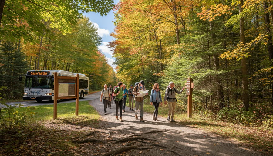
Getting to Ontario’s trails by public transit isn’t just a backup plan—it’s often the better choice. No circling crowded parking lots, no parking stress, and no worrying about leaving your vehicle at a remote trailhead. Instead, you’ll arrive refreshed, ready to hike, and already immersed in the adventure before your boots hit the trail.
The movement toward sustainable outdoor recreation is growing, and you can be part of it. Whether you’re a seasoned hiker looking to reduce your environmental footprint or someone hesitant about car-free travel, there’s never been a better time to try transit-to-trail access. Start small with a familiar route near your city, then expand your horizons as you gain confidence.
Ontario’s trails are waiting, and they’re easier to reach than you think. Pack your backpack, download that transit app, and discover how freeing it feels to let someone else handle the driving while you simply enjoy the journey. Your next great outdoor adventure is just a bus or train ride away.









+ There are no comments
Add yours