
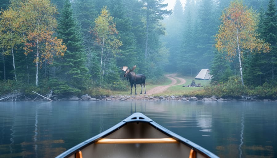
Ontario Parks has updated its wildlife activity protocols across multiple sites this September, introducing area closures and new encounter-reporting guidelines that will affect where you can hike, camp, and paddle through the fall season. If you’re planning a trip in the coming weeks, certain trails and backcountry zones may be temporarily off-limits due to increased bear activity and moose encounters reported in popular recreation corridors.
The changes reflect a proactive shift in how park managers balance visitor safety with habitat protection. Instead of reactive closures after an incident, staff are now monitoring wildlife movement patterns and closing zones preemptively when activity spikes. For campers and day-trippers, this means checking the latest advisories before you leave home has become essential, not optional.
What makes this round of updates different is the integration of visitor-reported sightings into closure decisions. Your observations now feed directly into park management choices. The system works best when everyone participates: snap a quick photo from a safe distance, note the time and location, and file a report through park staff or the online portal when you return to cell service. These real-time insights help rangers identify hotspots and adjust access faster than traditional monitoring alone.
Understanding why certain areas close and how long restrictions typically last will help you adapt your itinerary without scrapping your adventure altogether.
What Changed: New National Wildlife Control Measures
In early 2026, Ontario Parks rolled out significant updates to wildlife management protocols across its provincial network. These changes directly affect how visitors interact with natural spaces, particularly during peak wildlife activity seasons from spring through early fall.
The new measures took effect in phases between January and March 2026, with full implementation achieved by April 1st. They apply to all provincial parks and conservation reserves, with enhanced protocols specifically targeting areas known for bear, moose, and wolf activity. The updates emerged from a comprehensive review of visitor-wildlife encounters over the past three years, combined with feedback from park wardens, conservation officers, and emergency response teams.
The scope extends beyond traditional campgrounds. Day-use areas, hiking trails, canoe routes, and even some parking lots now fall under the revised wildlife management framework. Remote backcountry zones received particular attention, with new protocols addressing the challenge of communicating wildlife movements to dispersed campers who may be days away from park offices.
What sets these 2026 updates apart is their emphasis on prevention rather than reaction. Previous policies focused heavily on responding to encounters after they occurred. The current approach shifts resources toward predictive monitoring, using wildlife tracking data and seasonal patterns to close areas before conflicts develop, not after someone has a close call.
Key Developments in Wildlife Management
1. Enhanced Area Closure Protocols
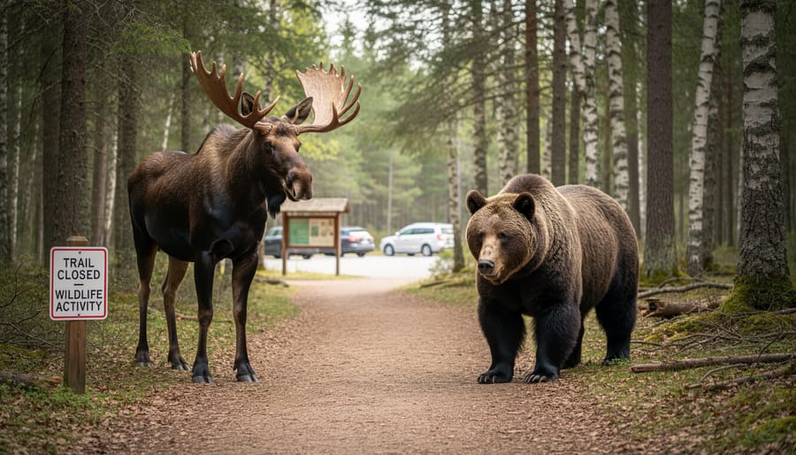
Ontario Parks has rolled out a more structured approach to area closures, moving away from ad-hoc decisions toward a tiered system that responds to specific wildlife thresholds. When animal activity reaches defined levels, measured through sightings, trail camera data, and field reports, parks can now trigger temporary or seasonal closures much faster than before. Instead of waiting days for administrative approval, on-the-ground staff have authority to close trails, campsites, or entire zones within hours if conditions warrant.
The system classifies closures into three categories: immediate (active threat or aggressive encounter), short-term (elevated activity lasting days to weeks), and seasonal (breeding, denning, or migration periods). Each category follows a different notification protocol. Immediate closures appear on park websites and digital kiosks within two hours, while seasonal closures are announced at least two weeks in advance whenever possible. If you arrive to find your trail blocked signage now explains the specific wildlife reason and provides alternate routes or rescheduling guidance.
Common triggers include:
- Bear activity: repeated sightings, food-conditioning behaviour, or denning near high-traffic areas
- Nesting season: protection zones for species at risk during breeding periods
- Migration patterns: waterfowl staging areas or caribou movement corridors
- Predator sightings: wolves, cougars, or coyotes exhibiting bold or habituated behaviour
- Disease management: containment zones for rabies, chronic wasting disease, or avian flu outbreaks
Parks post closure maps on their websites and through the Ontario Parks app, updated twice daily during peak season. The shift means fewer surprises at trailheads but requires checking conditions the morning of your trip rather than relying on week-old plans.
2. Real-Time Wildlife Advisory System
Ontario Parks has rolled out a modernized digital notification system that delivers wildlife encounter alerts directly to your smartphone or tablet while you’re on the trail or at your campsite. The platform pushes geolocation-based updates when rangers log sightings of bears, moose, wolves, or other significant wildlife activity within a five-kilometer radius of your registered location. Visitors who download the Ontario Parks app and enable location services receive instant push notifications, eliminating the need to check bulletin boards or wait for campground staff announcements.
The system pulls data from multiple sources: ranger field reports, trail camera networks positioned at key wildlife corridors, and verified visitor submissions through the app’s “Report a Sighting” feature. When you report an encounter, you can attach photos, mark the exact GPS coordinates, and note the animal’s behavior, whether it appeared habituated to humans, displayed defensive postures, or moved away quickly. This crowdsourced intelligence complements official monitoring and helps create a real-time activity map accessible to all park users.
Each advisory includes practical details: the species involved, time of sighting, whether young were present, and recommended precautions for that specific area. If activity intensifies in one zone, the system escalates from a standard advisory to a caution or warning level, which can trigger temporary trail detours or campsite relocations. Visitors without smartphones can still access printed summaries at visitor centers, updated every six hours during peak season.
3. Expanded Visitor Education Requirements
Starting in March 2026, Ontario Parks rolled out mandatory education checkpoints at trailheads and campground entrances serving high-activity wildlife zones. You’ll now encounter digital kiosks and staffed stations where you acknowledge that you’ve reviewed area-specific wildlife protocols before proceeding into sensitive backcountry areas or bear-frequented campgrounds.
The new signage system uses colour-coded warnings. Green signs mark standard wildlife awareness zones with general tips. Yellow indicates elevated activity, requiring you to watch a brief video or read updated materials about recent sightings and proper food storage. Red designates critical zones where you must complete a short safety quiz covering bear spray use, encounter response, and emergency procedures before staff grant access.
Park gates now distribute laminated quick-reference cards detailing the wildlife species active in your destination, their typical behaviour during your visit dates, and step-by-step encounter protocols. These cards replace the generic pamphlets previously available at visitor centres.
If you’re camping in areas where black bears, moose, or wolves have shown increased activity, expect a five-minute orientation session when you check in. Rangers explain current movement patterns, demonstrate proper food locker use, and confirm you carry recommended safety gear. The system tracks completion through your park reservation, streamlining re-entry if you leave and return during your stay.
Why It Matters for Your Ontario Adventure
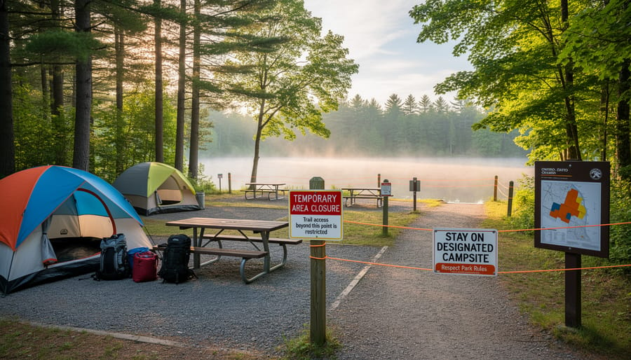
These updated policies reshape how you experience Ontario’s wilderness in three direct ways. First, your arrival routine changes: certain trailheads and backcountry zones now require a quick safety briefing or digital acknowledgment before that gate swings open, adding five to ten minutes to check-in but equipping you with current bear-activity maps and encounter protocols. Second, spontaneous itinerary shifts become more common. A trail you scouted online last week might close overnight due to a moose with calf sighting, so flexibility matters more than rigid schedules, building a Plan B campsite or alternate route into your trip prevents disappointment.
Third, the real-time notification system turns your phone into a safety tool rather than a distraction. Opt-in text alerts mean you’ll know within minutes if a black bear lingers near your planned lunch spot, letting you reroute before an encounter becomes a problem. For families, scout leaders, and first-time campers, this layer of situational awareness reduces anxiety and builds confidence, you’re not guessing about wildlife presence, you’re responding to verified data. The trade-off is a slightly more structured experience, but the payoff is tangible: fewer dangerous surprises, better-informed decisions, and the peace of mind that comes from knowing park staff are actively managing risks behind the scenes.
What to Watch: Upcoming Changes and Seasonal Considerations
Wildlife patterns shift with the seasons, and the new control measures will adapt accordingly. Spring bear activity typically peaks as animals emerge from hibernation, so expect heightened advisories and possible trail restrictions in May and June across popular parks like Algonquin and Killarney. Summer brings its own challenges, moose encounters increase near water sources during hot spells, while fall sees deer rutting season overlap with peak backcountry camping.
Park authorities plan quarterly reviews of the advisory protocols through 2026, with potential adjustments to closure trigger points based on encounter data collected during high-traffic periods. If you’re planning multi-season trips, bookmark the provincial parks alert page and sign up for SMS notifications. Weather conditions also play a role in wildlife behavior; drought or fire can push animals into unexpected areas, much like what that smoke means for shifting camping zones during wildfire season.
Watch for pilot programs testing wildlife cameras at trailheads and expanded ranger patrols in shoulder seasons. The system learns as it operates, so the notifications you receive in late 2026 will likely be more precise than those issued this spring. Stay flexible with your itinerary and check updates within 24 hours of arrival, conditions change faster than static websites can reflect.
Your Questions Answered
How do I find current wildlife advisories before my trip?
Check the official Ontario Parks website and your specific park’s page for real-time updates, and download the park’s mobile app if available for push notifications. Many parks now post daily advisories on social media channels as well.
What should I do if an area closes while I’m already camping?
Park staff will contact you directly if you’re in an affected area and provide relocation options or assistance. Always leave your itinerary and campsite details at the park office so rangers can reach you quickly during emergencies.
Are wildlife-related closures always announced in advance?
Not always, some closures happen suddenly when rangers spot aggressive wildlife behaviour or fresh evidence of dangerous activity. That’s why checking for updates each morning of your trip is now strongly recommended, similar to how visitors monitor camping fire restrictions during dry conditions.
How does this affect backcountry camping permits?
Your permit remains valid, but you may need to adjust your route if certain trails or campsites close. Park offices will help you modify your itinerary at no extra charge when closures are wildlife-related.
The new system is designed to keep you informed without disrupting your adventure. Most closures are temporary and localized, affecting specific trails or campsites rather than entire parks. By staying connected through the digital advisory tools and respecting closure notices, you’ll help protect both yourself and Ontario’s incredible wildlife while still enjoying everything these natural spaces offer.
These wildlife control updates reflect Ontario Parks’ commitment to keeping you safe while preserving the incredible natural spaces we all cherish. Stay informed through official park channels before each visit, respect closure advisories, and follow wildlife encounter protocols. Your cooperation helps protect both the wildlife that makes Ontario special and ensures these parks remain accessible for future adventurers. Plan smart, stay alert, and enjoy everything Ontario’s outdoors has to offer with confidence.










+ There are no comments
Add yours