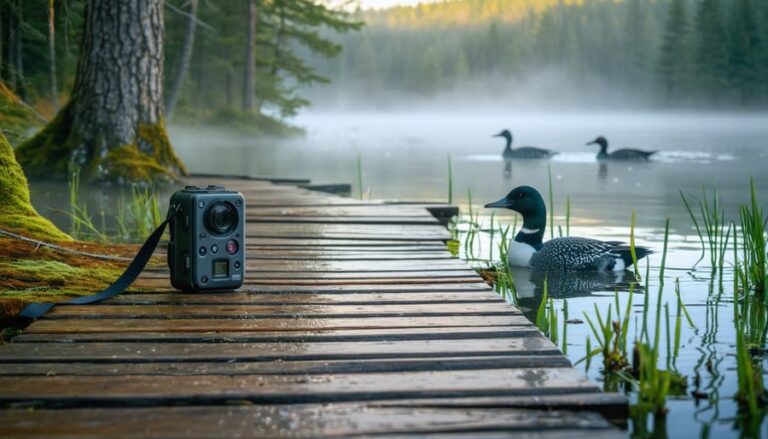
Picture this: You’re hiking a pristine trail in Algonquin Park, watching a family of loons glide across a crystal lake, completely unaware that artificial intelligence helped protect this exact moment. Before a single tree was cleared for that boardwalk beneath your feet, before that parking lot was paved, sophisticated AI tools analyzed thousands of data points to ensure minimal disruption to wildlife habitats, water quality, and forest ecosystems.
Environmental Impact Assessment has evolved far beyond clipboard-wielding researchers trudging through wilderness. Today’s technology can predict how a new campground might affect migratory bird patterns three years down the line, or identify the precise location for a visitor center that protects sensitive wetlands while maximizing your access to Ontario’s natural wonders. These smart systems process satellite imagery, wildlife tracking data, and climate patterns faster than traditional methods ever could, turning months of assessment into weeks without sacrificing accuracy.
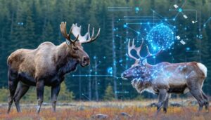
For anyone who treasures Ontario’s parks, this technological revolution means better protected spaces and smarter development. That new trail expansion you’ve been waiting for? It’s happening faster because AI identified low-impact routes through comprehensive terrain analysis. Those thriving moose populations you’re hoping to photograph? They’re flourishing partly because machine learning detected subtle habitat threats human observers missed.
The marriage of environmental science and artificial intelligence isn’t just preserving Ontario’s outdoor playground—it’s ensuring your grandchildren will experience the same breathtaking wilderness you enjoy today, possibly even healthier and more vibrant than before.
What Environmental Impact Assessments Really Mean for Your Favorite Parks
You know that feeling when you discover the perfect lakeside campsite at Frontenac Provincial Park, or stumble upon a secluded trail where you spot a family of deer? Those magical moments don’t just happen by accident. Behind the scenes, Environmental Impact Assessments work like protective shields, ensuring the places we love stay wild and wonderful for years to come.
Think of an EIA as a thorough health check-up for nature before any new development happens. Whether it’s upgrading facilities at your favorite camping area, adding new boardwalks through sensitive wetlands, or expanding parking lots to accommodate more visitors, these assessments predict how changes might affect everything from nesting birds to water quality.
Here’s what makes this matter for your next outdoor adventure: EIAs are the reason that stunning interpretive trail at Frontenac winds carefully around ancient rock formations instead of bulldozing through them. They’re why new facilities get built away from critical wildlife corridors, so you can still watch turtles basking on logs without disturbing their habitat.
These assessments examine soil stability (keeping trails from eroding), water drainage patterns (protecting swimming spots), and animal migration routes (preserving those incredible wildlife viewing opportunities). When done right, they balance our need for accessible parks with nature’s need for protection.
The really exciting part? Modern EIA tools now use advanced technology to create detailed environmental maps and predict long-term impacts with impressive accuracy. This means park planners can design improvements that enhance your experience while minimizing ecological footprints. That new accessible trail to the lookout point? The one with perfectly placed rest areas and minimal tree removal? Thank an EIA for making it possible.
Next time you’re enjoying a well-maintained Ontario park, remember there’s sophisticated environmental planning ensuring those gorgeous landscapes remain unspoiled. It’s conservation and recreation working together, so future generations can make the same incredible memories you’re creating today.

The Old Way Was Slow (And Sometimes Wrong)
Picture this: A beloved provincial park in Ontario wants to add a new interpretive trail through a wetland area. Sounds straightforward, right? Well, not quite. Back in the day, before technology stepped in to help, the environmental impact assessment process could take months—sometimes even years.
Here’s what used to happen. Environmental consultants would spend weeks trudging through the property with clipboards and field guides, manually cataloging every plant species, tracking animal movements, and taking soil samples by hand. They’d return to their offices with boxes of notes and specimens, then spend countless hours compiling reports. One wrong identification or a missed species during survey season? You’d have to start over.
I remember chatting with a park ranger who told me about a trail project near Algonquin that got delayed for nearly eight months because the initial assessment missed a critical breeding ground for a threatened salamander species. The surveyors had visited during the wrong season, so they simply didn’t see the evidence. By the time they discovered the mistake, they had to redo everything, pushing the project back and frustrating everyone involved—especially visitors who’d been eagerly awaiting the new trail access.
The human element meant assessments were only as good as the individual experts conducting them, and even the best professionals could miss things. Weather delays, limited budgets, and the sheer vastness of Ontario’s wilderness made comprehensive surveys nearly impossible. Projects sat in limbo while wildlife habitats remained in question, and park improvements that could enhance visitor experiences were put on hold indefinitely.
How AI Tools Are Reading the Land Like Never Before
Spotting Wildlife Patterns From Above
Picture this: a bird’s eye view of Ontario’s wilderness, where technology watches over wildlife without disturbing a single creature. That’s the magic happening right now across our provincial parks. AI-powered systems analyze thousands of drone and satellite images to create detailed maps of animal habitats and track seasonal migration patterns, all while keeping a respectful distance.
Here’s where it gets really exciting for your next park visit. When you’re planning that spring camping trip, these tools have already identified sensitive nesting areas, allowing park managers to adjust trail access and protect vulnerable wildlife. In several Ontario parks, AI-enhanced GPS tracking combined with aerial imagery has helped safeguard osprey and heron nesting sites that might otherwise go unnoticed until it’s too late.
The best part? This technology means better wildlife viewing opportunities for you. By understanding where animals naturally congregate, parks can position observation platforms and viewing areas in spots that maximize your chances of spotting incredible Ontario wildlife while ensuring the animals remain undisturbed in their natural behaviors. It’s a win-win for conservation and your outdoor adventures.
Predicting Problems Before They Happen
Imagine planning a new hiking trail through pristine Ontario wilderness. In the past, trail designers would make educated guesses about where to route paths, sometimes discovering problems only after erosion scars appeared or wildlife habitats were disrupted. Today’s machine learning models change everything by essentially looking into the future.
These AI systems analyze soil composition, rainfall patterns, slope angles, and vegetation data to predict exactly where erosion will occur before a single footstep touches the ground. They map underground water flows to flag areas where trail construction might contaminate streams or wetlands. By processing thousands of data points collected through smart sensor technology and satellite imagery, the models identify sensitive breeding grounds and migration corridors that need protection.
Here’s a real-world win: When planners designed new trails in several Ontario parks recently, AI modeling helped them route paths that avoided fragile wetland edges and nesting areas. The result? Beautiful trails that let you experience nature’s wonders while keeping ecosystems thriving. It’s like having a crystal ball that shows environmental consequences decades ahead, ensuring the trails you love today will still be pristine for your grandchildren to explore.
Faster Decisions, Better Protection
Here’s the thing about traditional environmental assessments: they can take forever. We’re talking six months to a year sometimes, which means that amazing new trail you’ve been eyeing or those crucial habitat protections sit in limbo while paperwork piles up. But AI is changing the game in Ontario’s parks, and honestly, it’s pretty exciting for all of us who love getting outdoors.
These smart tools can crunch through data that would take humans months to analyze, completing assessments in just weeks. Think satellite imagery, wildlife movement patterns, soil samples, and visitor impact reports all processed simultaneously. What used to require teams of specialists working sequentially now happens in parallel, thanks to machine learning algorithms that spot patterns and potential issues lightning-fast.
For you as a park visitor, this speed translates into real benefits. Conservation measures get implemented before sensitive areas suffer damage. New facilities open sooner while still meeting rigorous environmental standards. That eroded section of trail gets rerouted faster, protecting both the landscape and your hiking experience.
Here’s an insider tip: faster assessments also mean park managers can respond more quickly to emerging issues, like adapting trails when endangered species need protection during nesting season. You get to enjoy better-maintained parks while knowing the environment receives the urgent care it deserves.
Real Results You Can See on the Trail
Let me tell you about some game-changing results happening right here in Ontario that show how this technology actually works on the ground.
Take the Bruce Peninsula National Park, where AI-powered assessment tools helped planners redesign a popular hiking route near sensitive alvars. These unique limestone plains host rare plants found nowhere else in Canada. By analyzing thousands of data points about soil composition, water flow patterns, and plant distribution, the AI identified an alternative trail route just 200 meters away that offered equally stunning Georgian Bay views without trampling fragile flora. The result? Hikers still get their Instagram-worthy lookouts, and the rare lakeside daisy populations have rebounded by 40% since the reroute.
Over in Algonquin Provincial Park, environmental planners used AI assessment tools to evaluate a proposed canoe launch expansion. The technology crunched data from wildlife tracking technology, historical water quality reports, and seasonal visitor patterns. The surprising recommendation? Move the launch 500 meters downstream where a natural rocky outcrop provided better access while avoiding a key moose calving area. Park managers told me visitors now enjoy easier launches on a more stable shoreline, and moose sightings in that corridor have actually increased because the animals feel safer.
The Rouge National Urban Park near Toronto offers another success story. AI tools helped identify which meadow restoration areas could handle increased foot traffic and which needed protection. The assessment revealed that three proposed picnic sites would fragment critical pollinator corridors. Planners adjusted, clustering facilities in one location instead. Now families enjoy better amenities in a centralized hub, while native bee populations have thrived in the undisturbed meadows surrounding the area.
Perhaps most impressive is what happened at Frontenac Provincial Park, where AI-assisted planning helped protect a previously unknown wetland complex during trail expansion planning. The technology flagged unusual drainage patterns that human surveyors might have missed. Further investigation revealed a rare fen ecosystem supporting endangered spotted turtles. The trails were rerouted, the fen received protected status, and interpretive signage now educates visitors about this hidden gem they’re helping preserve just by staying on the path.

What This Means for Your Next Park Adventure
The next time you lace up your hiking boots for a Frontenac adventure, you’ll be walking trails shaped by incredibly smart technology. AI-driven environmental impact assessments are working behind the scenes to make your park visits more magical while protecting the wilderness you came to enjoy.
Here’s what this means in practical terms: those new boardwalks you cross? They’re positioned to avoid sensitive wetlands that AI mapping identified as crucial for amphibian breeding. That pristine campsite with the perfect lake view? It was selected using data that ensures minimal disruption to wildlife corridors, so deer, bears, and other animals can still move safely through their traditional routes. Even the parking areas and visitor centers are increasingly designed with AI insights that reduce erosion, protect water quality, and preserve the natural beauty you’re here to experience.
These technologies work hand-in-hand with monitoring systems that continuously track environmental health, creating a feedback loop that keeps improving park management. The result? Cleaner campsites, healthier forests, and more opportunities for enhanced park experiences that don’t compromise the ecosystem.
You can support these conservation efforts with some simple practices. Stick to designated trails, even when that shortcut looks tempting—those trail placements are strategic. Pack out everything you pack in, and consider bringing a small bag for any litter you encounter. Choose quieter times to visit popular spots, spreading out visitor impact throughout the day. And when you see restoration areas or wildlife corridors marked, respect the boundaries—they’re protecting tomorrow’s wilderness.
Every mindful choice you make amplifies the work these sophisticated tools are doing. Together, technology and thoughtful visitors create a winning combination that keeps Ontario’s parks spectacular for generations to come.
The Human Touch Still Matters
Here’s something that might surprise you: despite all this amazing technology we’ve been talking about, the real magic happens when AI works alongside people, not instead of them. Think of these tools as incredibly helpful assistants rather than replacements for the environmental scientists, park rangers, and community members who know Ontario’s landscapes best.
When Ontario Parks plans a new trail or facility, AI might crunch the numbers on soil erosion or wildlife patterns, but it’s the local experts who interpret what those findings really mean. Indigenous communities bring generations of traditional ecological knowledge that no algorithm can replicate—understanding seasonal animal behaviors, plant relationships, and land patterns that have been observed for centuries. These insights are absolutely essential to creating assessments that truly protect our natural spaces.
I’ve seen this collaboration firsthand at community consultation sessions for park developments. Environmental scientists present AI-generated data about potential impacts, then spend hours listening to residents share their observations: where the deer cross in winter, which wetlands flood first in spring, or how a particular forest grove serves as a bird sanctuary. This human input often catches things that sensors and satellites miss.
The technology also makes it easier for everyday people to participate in environmental stewardship. Citizen science apps let hikers report trail conditions or wildlife sightings, feeding valuable real-world data into assessment systems. Your observations during a weekend camping trip might actually help shape conservation decisions.
So while AI provides incredible analytical power, it’s the combination of cutting-edge technology and human wisdom—from scientists to Indigenous Elders to curious park visitors like you—that keeps Ontario’s natural spaces thriving for everyone to enjoy.
The next time you find yourself standing at a breathtaking lookout in Algonquin Park or walking a perfectly maintained trail through Bruce Peninsula, take a moment to appreciate the invisible guardians working behind the scenes. AI-driven environmental impact assessments are quietly revolutionizing how Ontario protects its natural treasures, ensuring that the parks you love today will be even better for your children and grandchildren to explore tomorrow.
These smart technologies aren’t just abstract computer systems in government offices. They’re the reason new boardwalks don’t disturb nesting sites, why trail expansions avoid sensitive habitats, and why you can still spot that family of deer on your favourite hiking route. Every thoughtful decision about where to place a new campground or how to manage visitor flow comes from data-driven insights that balance human enjoyment with nature’s needs.
Here’s something wonderful to consider: while you’re capturing that perfect sunset photo or roasting marshmallows with your family, these systems are continuously monitoring and protecting the ecosystem around you. They’re working 24/7 so you don’t have to worry about whether your visit is harming the environment you came to enjoy.
So here’s my challenge to you: explore Ontario’s parks responsibly. Pack out what you pack in, stick to marked trails, and respect wildlife viewing distances. Consider supporting conservation initiatives through park donations or volunteer programs. When you understand the incredible effort behind preserving these spaces, every outdoor adventure becomes more meaningful. Your love for these wild places, combined with smart technology, creates a powerful partnership for conservation.


+ There are no comments
Add yours