

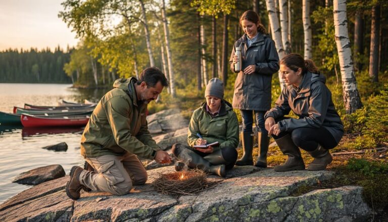
Step into the heart of Ontario’s wilderness with a map, compass, and the ancient wisdom that guided explorers for centuries. In these vast landscapes where cell signals fade and GPS batteries die, mastering traditional navigation becomes your lifeline. From the dense boreal forests of Algonquin to the rugged shores of Lake Superior, knowing how to read nature’s signposts transforms an uncertain journey into a confident adventure.
Before technology drew blue lines on smartphone screens, travelers relied on the sun’s arc, wind patterns, and tree growth to find their way. These time-tested techniques, combined with modern tools, create the perfect blend of reliability and precision for today’s wilderness explorer. Whether you’re planning a weekend backpacking trip or an extended wilderness expedition, understanding navigation fundamentals isn’t just about reaching your destination – it’s about returning home safely with stories to tell.
Across Ontario’s 200,000 square kilometers of protected wilderness, every trail junction and water crossing presents a chance to practice these essential skills. This guide merges traditional knowledge with cutting-edge methods, ensuring you’re prepared for whatever challenges the Canadian wilderness presents.
Let’s explore the essential techniques that will keep you oriented and confident in the wild, where every journey begins with understanding which way is north.

Essential Navigation Tools for Ontario’s Backcountry
Traditional vs. Modern Navigation Tools
While modern technology has revolutionized wilderness navigation, it’s essential to master both traditional navigation methods and contemporary tools for a safe backcountry experience.
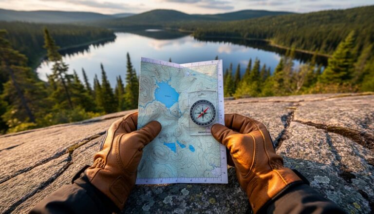
A topographic map and compass remain the most reliable navigation duo – they never run out of batteries or lose signal! In Ontario’s wilderness, these tools have guided countless adventurers through dense forests and across intricate lake systems. I always recommend waterproof maps from the Ontario Parks store, which include essential details like portage routes and campsite locations.
However, GPS devices and smartphone apps have their place in modern navigation. Apps like Avenza Maps and AllTrails offer detailed Ontario trail systems and work offline – just remember to download your maps before heading out. Many experienced hikers use the “GPS and paper” approach: relying primarily on traditional tools while using digital aids as backup.
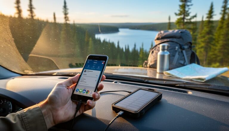
Pro tip: If you’re using your smartphone for navigation, pack a portable battery bank and keep your device in airplane mode to extend battery life. For dedicated GPS units, consider models with replaceable batteries rather than built-in rechargeable ones.
Remember, electronic devices can fail when you need them most. That’s why I always tell my hiking buddies: learn to read a map and compass first, then embrace modern tools as helpful additions to your navigation toolkit.
Weather-Proof Your Navigation Kit
Ontario’s weather can be unpredictable, from summer downpours to winter snowstorms, so protecting your navigation tools is crucial for safe wilderness exploration. Here’s how to keep your gear working reliably in any conditions.
Start by storing your compass and maps in waterproof cases or heavy-duty zip-lock bags. For paper maps, consider using a transparent map case with a neck strap – this keeps your hands free while hiking and provides instant access when needed. Pro tip: pack extra zip-lock bags; they’re lightweight and can be lifesavers if your primary protection fails.
For electronic devices like GPS units or smartphones, invest in waterproof cases and carry backup power banks in sealed containers. Remember that cold temperatures drain batteries faster, so keep electronic devices close to your body during winter adventures to maintain battery life.
Treat paper maps with waterproofing spray before your trip, or better yet, print them on waterproof paper. Keep a pencil instead of a pen for marking routes – pencil marks won’t run if your map gets wet, and they’re easier to erase for future use.
In winter, store your compass in an inside pocket to prevent the liquid from freezing. A frozen compass can give inaccurate readings and might crack. For summer hiking, protect your navigation tools from excessive heat by keeping them out of direct sunlight when possible.
Regularly check and maintain your gear before each trip, ensuring everything is clean, dry, and functioning correctly. A well-maintained navigation kit can mean the difference between a great adventure and a wilderness mishap.
Reading Ontario’s Natural Signs
Tree and Plant Indicators
Nature provides some fascinating clues to help you find your way in Ontario’s wilderness, and our local trees and plants are particularly helpful navigation tools. In our northern hemisphere, moss typically grows more abundantly on the north side of trees, rocks, and fallen logs due to the shadier, moister conditions. While this isn’t a foolproof method, it’s a helpful indicator when used alongside other navigation techniques.
Many of our local trees also give away directional hints. Pine trees in exposed areas tend to grow more branches on their southern side, where they receive more sunlight. You might notice that these trees appear fuller and healthier on their south-facing side. Similarly, tree rings often grow thicker on the southern side of the trunk, though you’ll only spot this on fallen trees.
Look out for wild flowers in our forests – they usually face south to soak up maximum sunlight. Common Ontario species like Black-eyed Susans and Chicory are excellent solar trackers. During peak growing season, you might notice that many flowering plants lean slightly southward.
Here’s a local tip: in areas with decent sun exposure, raspberry and blackberry bushes often produce more fruit on their south-facing sides. While foraging, you might notice this pattern, which can help confirm your directional bearings.
Remember that these natural indicators aren’t perfect – local conditions like shade from larger trees, nearby buildings, or unusual weather patterns can affect plant growth. Always use these botanical clues as part of a broader navigation strategy, preferably alongside a compass and map.

Sun and Star Navigation
Looking up at Ontario’s night sky can be your trusty compass when traditional navigation tools aren’t available. At our latitude (ranging roughly from 42° to 52° North), the North Star (Polaris) appears higher in the sky than many visitors expect – typically about halfway up from the horizon, depending on your location in the province.
To find Polaris, look for the Big Dipper constellation, which is visible year-round in Ontario. The two stars at the end of the Dipper’s “bowl” point directly to the North Star. Once you’ve located it, you’re facing true north, making it easier to orient yourself in any direction.
During daylight hours, the sun becomes your celestial guide. Remember that in Ontario, the sun rises in the east around 6 AM and sets in the west around 6 PM, though exact times vary by season. At noon, the sun is directly south – but here’s a local tip: in Ontario, we need to account for daylight saving time, so solar noon actually occurs around 1 PM during summer months.
A handy trick for estimating remaining daylight is the “hand method”: Hold your hand at arm’s length, with fingers horizontal. Each finger width between the sun and the horizon represents roughly 15 minutes of remaining daylight. This works particularly well in summer when we enjoy long daylight hours.
For the most accurate readings, find a clear spot away from the dense canopy of our boreal forests. Lakes and clearings make ideal observation points, offering unobstructed views of both the sun and stars.
Trail Marking and Signaling Systems

Official Park Trail Markers
When hiking in Ontario Parks, you’ll encounter a standardized trail marking system that makes navigation straightforward and reliable. The most common markers are the painted blazes on trees – typically 5 cm wide by 15 cm long rectangles. A single blaze indicates you’re on the right path, while two blazes signal an upcoming turn or junction.
Different trail difficulties are color-coded for easy identification. Blue markers typically indicate easier, beginner-friendly trails, while white blazes are used for more challenging routes. Yellow markers often designate side trails or connecting paths, and red blazes are reserved for advanced or specialty trails.
At trail intersections, you’ll find numbered posts or markers that correspond to your trail map. These numbers are essential reference points for both navigation and emergency situations. Keep an eye out for interpretation panels at key points along the trail, which often include “You Are Here” maps and distance markers.
Pro tip: Take a photo of the trail map at the trailhead with your phone. Even if you lose cell service, you’ll have a digital backup of the route. Also, pay attention to the small diamond-shaped markers that indicate if you’re on a one-way or loop trail – they’re easy to miss but incredibly helpful for staying oriented.
Remember that while trail markers are reliable, they should be used in conjunction with your map and compass for the safest wilderness experience.
Emergency Signals That Work
When you need help in Ontario’s wilderness, having the right signaling techniques can make the difference between a close call and a crisis. As part of essential wilderness survival skills, mastering these proven signals is crucial.
The universally recognized SOS signal (three short, three long, three short) can be created using various methods. Flash your headlamp or flashlight in this pattern, or arrange large branches or rocks to form three sets of signals visible from above. Pro tip: bright-colored clothing or gear spread out in a clearing creates excellent contrast against our green Ontario forests.
Sound signals work exceptionally well in our dense woodland. Three sharp whistle blasts, repeated at regular intervals, is the standard distress call. Remember to pace yourself to conserve energy and your whistle’s air supply. If you’ve packed an emergency mirror (and you should!), use it to reflect sunlight toward aircraft or distant high points. On sunny days, these flashes can be spotted from kilometers away.
For wilderness explorers carrying a cell phone, remember that even without service, dialing 911 might still work as emergency signals can often get through when regular calls can’t. Plus, a little-known trick: placing your phone in airplane mode and back can force it to search for new towers, potentially connecting you to emergency services.
Local Navigation Challenges and Solutions
Ontario’s wilderness presents unique backcountry navigation challenges that even experienced outdoors people need to prepare for. Dense forest canopies can limit GPS signals and make it tricky to spot landmarks, while the Canadian Shield’s countless lakes and similar-looking landscapes can be disorienting.
One of the biggest challenges I’ve encountered while guiding in Ontario is what we call “lake confusion” – where one body of water looks remarkably similar to another. To overcome this, I always recommend creating “lake profiles” by noting distinctive features like unusual rock formations, beaver dams, or fallen trees at key points along your route.
The changing seasons add another layer of complexity. Summer’s thick foliage can obscure trail markers, while winter’s snow cover can completely transform familiar landscapes. Here’s my tried-and-tested approach: during summer, look for blazes (trail markers) at eye level and maintain closer contact with your group. In winter, carry additional navigation tools and stick to well-marked trails unless you’re highly experienced.
Magnetic disruptions are another unique challenge in parts of Ontario, particularly in areas rich in iron ore deposits. Your compass readings might be affected, so it’s essential to:
– Cross-reference your compass with multiple navigation tools
– Mark your position more frequently on your map
– Use natural navigation methods as backup (sun position, wind direction)
Low-visibility conditions, common during early morning fog near lakes or during sudden weather changes, can make navigation particularly challenging. I always suggest waiting it out when possible, but if you must move, use these local tricks:
– Follow contour lines rather than trying to maintain a straight course
– Use sound cues like running water or highway noise
– Mark your path with biodegradable trail tape (remember to collect it on your return)
Remember, the best solution to navigation challenges is prevention through thorough preparation and having multiple navigation methods at your disposal.
As we wrap up our journey through wilderness navigation, remember that successful outdoor exploration in Ontario’s breathtaking landscapes comes down to preparation, awareness, and respect for nature. By combining traditional navigation skills with modern tools, you’ll be better equipped to handle whatever adventures come your way.
Keep these essential takeaways in mind: always carry multiple navigation tools, including a physical map and compass as your reliable backups. Study your route before heading out, and don’t forget to share your plans with someone you trust. Practice your navigation skills in familiar areas before tackling more challenging terrain, and stay aware of your surroundings at all times.
Remember that responsible navigation isn’t just about finding your way – it’s about preserving our natural spaces for future adventurers. Stick to marked trails when possible, follow Leave No Trace principles, and respect wildlife habitats. Consider joining a local outdoor club to learn from experienced navigators and connect with fellow nature enthusiasts.
Whether you’re planning a day hike in Algonquin Park or a week-long backcountry expedition, confidence in your navigation abilities will make your outdoor experiences more enjoyable and safer. Stay curious, keep learning, and never stop exploring Ontario’s wonderful wilderness – just make sure you know how to find your way back home!
Take that first step with confidence, and remember that every expert navigator started as a beginner. Happy trails!


+ There are no comments
Add yours