Transform your next Ontario Parks adventure with digital tools that put wilderness navigation at your fingertips. As technology transforms outdoor experiences, traditional paper maps are giving way to powerful smartphone apps and GPS devices designed specifically for exploring Ontario’s vast network of trails and waterways. Download the Ontario Parks app to access real-time trail conditions, interactive maps, and emergency contacts—even in areas with limited connectivity. Pair these digital resources with weather radar apps and wildlife tracking tools to create a comprehensive exploration kit that enhances safety while preserving the natural adventure experience. Whether you’re planning a day hike through Algonquin or a week-long backcountry expedition in Killarney, these modern tools combine the convenience of technology with the timeless thrill of outdoor discovery.
Essential Mobile Apps for Ontario Trail Navigation

Official Ontario Parks Apps
The Ontario Parks system offers two essential official apps that can enhance your outdoor adventures. The Ontario Parks app serves as your digital gateway to the province’s stunning parks, providing real-time updates on campsite availability, trail conditions, and park events. You can easily make and manage camping reservations, access interactive park maps, and store your camping permits right on your phone.
For wildlife enthusiasts, the Ontario Parks Passport app turns your park visits into an engaging collection experience. As you explore different parks, you can earn digital badges, track your visits, and participate in seasonal challenges. The app also includes a helpful species identification guide, making it perfect for budding naturalists and families looking to make their park visits more educational.
Both apps are free to download and work offline – a crucial feature when you’re deep in nature where cell service might be limited. They’re regularly updated with seasonal information, emergency notices, and park advisories, ensuring you always have the latest information at your fingertips. Pro tip: Download both apps and any necessary maps before heading out to ensure smooth functionality during your adventure.
Community-Favorite Trail Apps
Today’s trail enthusiasts swear by several must-have apps that make exploring Ontario’s wilderness both safer and more enjoyable. AllTrails consistently ranks as the community favorite, offering detailed trail maps, difficulty ratings, and recent conditions reported by fellow hikers. The free version is great for basic navigation, while premium subscribers can download offline maps for areas with spotty cell service.
Hiking Project is another gem loved by our park visitors, featuring user-submitted trail reports and photos that help you know exactly what to expect. For wildlife enthusiasts, iNaturalist has become an essential companion, allowing you to identify plants and animals while contributing to citizen science projects.
For weather tracking, many regular park-goers rely on Weather Underground, which provides hyperlocal forecasts that are crucial for planning safe adventures. And don’t forget about what3words – this innovative app has become a game-changer for sharing precise locations with friends or emergency services, dividing the world into 3-meter squares with unique three-word combinations.
Remember to download your maps and trail information before heading out, as cell service can be unreliable in more remote areas of our parks.
GPS Devices and Mapping Tools
Handheld GPS Units
When exploring Ontario’s vast wilderness, a reliable handheld GPS unit can be your best friend. While smartphones are convenient, dedicated GPS devices offer superior battery life and durability in challenging park conditions. The Garmin GPSMAP 64sx stands out as a favorite among Ontario trail enthusiasts, featuring excellent satellite reception even under dense forest canopy and a battery life that can last multiple days.
For budget-conscious explorers, the Garmin eTrex 22x offers great value while maintaining essential features like preloaded topographic maps and water resistance – perfect for those unexpected summer showers or canoe trips. More advanced users might appreciate the Garmin Montana 700i, which includes satellite messaging capabilities, crucial for areas where cell service is non-existent.
Pro tip: Always carry spare batteries and download offline maps before heading out. Even the best GPS units benefit from a backup power source, and Ontario’s remote areas can challenge even the strongest satellite signals. Consider models with both GPS and GLONASS support for improved accuracy in our northern latitudes.
Remember to treat your GPS as a complement to, not a replacement for, traditional navigation skills. A paper map and compass should always be part of your exploration toolkit, especially in areas like Algonquin Park where electronic devices can sometimes fail in extreme conditions.

Digital Trail Maps
Gone are the days of wrestling with paper maps in the wind! Ontario’s parks have embraced the digital age with an impressive array of mapping tools to help you navigate the trails with confidence. The official Ontario Parks website offers downloadable PDF maps for most provincial parks, but the real game-changers are the smart interactive maps that show you exactly where you are on the trail.
Popular apps like AllTrails and Avenza Maps feature detailed trail maps for Ontario’s parks, complete with elevation profiles, difficulty ratings, and user reviews. These apps work offline too – just remember to download your maps before heading out where cell service might be spotty!
For tech-savvy explorers, the Ontario Parks app provides real-time updates about trail conditions, park alerts, and even helps you find the nearest comfort station. Many parks also offer QR codes at trailheads that instantly load detailed route information to your phone.
Pro tip: While digital maps are incredibly convenient, always carry a backup paper map and make sure your device is fully charged. Mother Nature doesn’t always play nice with technology!
Safety and Emergency Tech Tools
Emergency Communication Devices
When venturing into Ontario’s wilderness, staying connected can be a matter of safety. Satellite communicators like the Garmin inReach or SPOT X have become essential tools for outdoor enthusiasts, offering two-way messaging and SOS capabilities even in areas without cell service. These pocket-sized devices can be lifesavers, letting you communicate with emergency services or loved ones from virtually anywhere in the province.
Personal Locator Beacons (PLBs) are another crucial safety tool, designed specifically for emergencies. While they don’t offer messaging features, they’re incredibly reliable for sending distress signals to search and rescue teams. Think of them as your emergency button in the backcountry – simple, straightforward, and potentially life-saving.
Pro tip: Before heading out, always test your device and ensure your subscription is active. Many Ontario Parks visitors centers can help you understand how to use these devices effectively. Remember to pack extra batteries and keep your device easily accessible, not buried in your backpack. While these devices provide peace of mind, they should complement, not replace, traditional outdoor safety practices and good judgment.
Weather Monitoring Tools
When exploring Ontario’s trails, having reliable weather information at your fingertips can make or break your outdoor experience. The Environment Canada Weather App is a must-have, offering accurate local forecasts and severe weather alerts specific to your hiking location. For a more detailed look at trail conditions, WeatherX provides hourly precipitation forecasts and wind direction data – particularly useful when planning hikes around the Great Lakes.
Many experienced hikers pair their phone apps with portable weather meters like the Kestrel DROP, which measures temperature, humidity, and barometric pressure right on the trail. These compact devices can alert you to sudden weather changes before they become visible, giving you plenty of time to seek shelter or adjust your plans.
For multi-day adventures, consider downloading Weather Underground, which offers extended forecasts and historical weather patterns for specific trail sections. The app’s crowd-sourced weather reports from fellow hikers provide real-time updates about trail conditions.
Pro tip: Always download offline weather maps before heading out, as cell service can be spotty in remote areas of Ontario’s parks. Remember to pack a basic compass as a backup – sometimes old-school tools are the most reliable!

Digital Trail Photography Tools
In today’s digital age, capturing and sharing your trail adventures has never been more exciting. Your smartphone can be your most versatile photography companion, equipped with powerful cameras and helpful apps that make trail photography a breeze. Consider downloading apps like Snapseed or VSCO for quick trail-side editing that brings out the vibrant fall colors or dramatic winter landscapes of Ontario’s parks.
For those wanting to dive deeper into digital nature journaling, combining photos with observations can create meaningful records of your outdoor experiences. Apps like iNaturalist help you identify and document flora and fauna while contributing to citizen science projects.
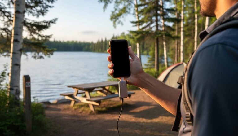
Pro tip: Pack a portable power bank for longer hikes, and consider a weather-resistant phone case for those unexpected rain showers. If you’re serious about trail photography, a lightweight tripod can help capture stunning sunrise shots at lookout points or steady your phone for low-light wildlife photos.
Remember to be mindful of your surroundings while photographing – stay on marked trails and maintain a safe distance from wildlife. Many Ontario parks now have designated photo spots marked with frames or platforms, perfect for capturing those Instagram-worthy moments safely.
Share your adventures responsibly by using park-specific hashtags and tagging @OntarioParks in your social media posts. This helps build our community of nature enthusiasts and inspires others to explore Ontario’s beautiful trails. Just remember to download your trail maps before heading out, as cell service can be spotty in more remote areas.
As we embrace the digital age of trail exploration, it’s crucial to strike a balance between leveraging technology and maintaining an authentic connection with nature. While apps and GPS devices have revolutionized how we navigate Ontario’s wilderness, they should enhance rather than replace our fundamental outdoor skills and awareness.
Looking ahead, we’re seeing exciting developments in augmented reality trail guides and crowd-sourced trail condition updates specific to Ontario Parks. These innovations promise to make our adventures safer and more informed, but remember – technology should be your trusted companion, not your sole guide.
Consider adopting the “tech-smart, nature-first” approach: check your apps and devices before hitting the trail, take screenshots of maps as backups, and then focus on immersing yourself in the natural world around you. Keep your phone in airplane mode when possible to extend battery life and minimize distractions.
As future technologies emerge, let’s commit to using them responsibly while preserving the untamed spirit of Ontario’s wilderness. After all, the most memorable moments often come when we look up from our screens and truly connect with the natural wonders surrounding us.


+ There are no comments
Add yours