

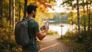
Picture this: you’re standing at a trail junction in Algonquin Park, and instead of squinting at a worn paper map, your smartphone shows you exactly what lies ahead—a drone’s-eye view of the waterfall just 500 meters up the path, complete with real-time weather conditions and crowd levels. This is real-time travel technology, and it’s transforming how we explore Ontario’s wilderness.
Real-time travel combines live drone footage, GPS tracking, and instant data updates to give you a virtual preview of destinations before you even lace up your hiking boots. Think of it as having a scout fly ahead on every adventure, sending back intelligence about trail conditions, wildlife sightings, and scenic viewpoints worth the trek.
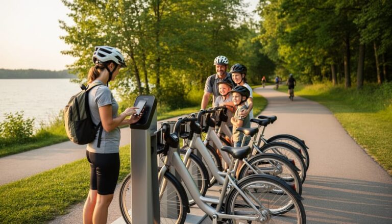
For Ontario park visitors, this isn’t science fiction—it’s becoming as essential as your water bottle. Whether you’re deciding between two trails at sunrise, checking if that remote beach is worth the canoe trip, or simply wanting to share live moments with friends back home, real-time travel tech puts unprecedented planning power in your pocket. The technology works seamlessly with your existing devices, requires minimal setup, and genuinely enhances your outdoor experience without replacing the raw thrill of discovery.
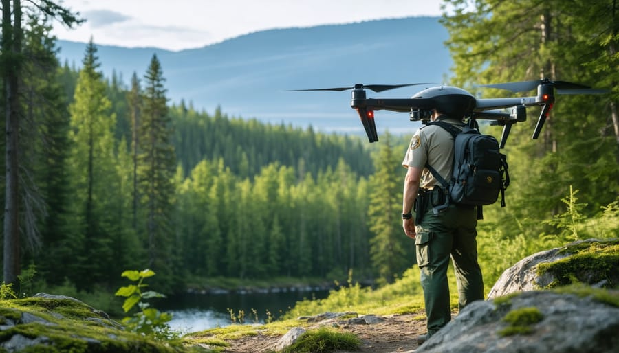
What Is Real-Time Drone Travel Narration?
Imagine standing at the edge of a breathtaking Ontario canyon, but instead of just reading about it online, you’re watching a drone soar through the landscape while a park ranger describes exactly what you’re seeing as it happens. That’s real-time drone travel narration, and it’s transforming how we experience natural spaces before we even lace up our hiking boots.
Here’s how it works: a skilled drone pilot captures live aerial footage of parks, trails, and natural landmarks while an expert guide provides commentary through a synchronized audio feed. This could be a naturalist pointing out a beaver dam as the drone flies over it, or a park ranger explaining the geological formation you’re watching unfold on screen. The key word is “live.” Unlike pre-recorded videos you might find on YouTube, this content happens in the moment, meaning you can ask questions, request different viewing angles, or explore specific areas that interest you.
What makes this different from virtual exploration technology is the spontaneity. Pre-recorded content is polished but static. Real-time narration adapts to weather conditions, wildlife sightings, and viewer curiosity. Spotted a moose near the shoreline? The drone can pivot to follow it while your guide shares insights about its behavior.
For outdoor enthusiasts and travelers, this technology offers something special: authentic exploration from your living room. You’re not just watching a video; you’re experiencing a guided tour that responds to the environment as it unfolds. It’s like having a personal park interpreter who can fly, giving you insider knowledge that helps you plan better visits and discover hidden gems you might otherwise miss.

How This Changes the Way You Plan Your Ontario Adventures
Scout Before You Trek
Think of real-time drone views as your digital hiking boots, letting you test the trail before you lace up. Before committing to that backcountry camping trip, you can assess current conditions from your couch. Water levels too high at your favorite crossing? You’ll know before you drive three hours north.
When scouting virtually, pay attention to details that matter most. Check trail surfaces for mud, snow patches, or fallen trees that might slow your pace. Scan camping areas for sun exposure and wind protection—nobody wants a tent in a wind tunnel. Look for proximity to water sources and flat ground that’ll actually fit your tent.
Here’s an insider tip: scout during similar weather conditions to when you plan to visit. A sunny afternoon view won’t show you those shadowy, mosquito-heavy sections that stay damp all day. Notice the vegetation density too—lush greenery might mean buggy conditions, while sparse coverage could mean exposed, hot hiking.
For accessibility, watch for steep grades, narrow passages, or tricky river crossings that photos alone might miss. These virtual scouts help you pack appropriately and set realistic expectations, turning potential surprises into well-planned adventures. It’s like having a friend who just returned from the trail, showing you exactly what awaits.
Ask Questions as You Explore
Here’s what makes real-time travel truly interactive: you’re not just watching someone else’s pre-recorded adventure. You can actually ask questions as the narrator explores, getting instant answers tailored to your interests.
Picture this: you’re watching a drone tour of Algonquin’s Highland Trail, and you wonder about bear activity in that area. Just type your question, and the guide responds in real-time, sharing insider tips about wildlife safety and the best times to hike bear-free. Or maybe you’re eyeing that backcountry campsite near a pristine lake. Ask about water access, mosquito levels in July, or whether your eight-year-old could handle the portage.
This interactive format works beautifully alongside AI-powered trip planning, letting you gather real-world insights before finalizing your itinerary. Common questions include trail conditions after spring thaw, camping permit requirements, fishing regulations for specific lakes, and accessibility features at trailheads.
Think of it as having a knowledgeable park friend who’s actually there right now, answering your specific concerns rather than generic FAQs. This personal touch helps you make confident decisions about where to go and what to pack.
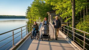
Experience Places You Can’t Physically Reach
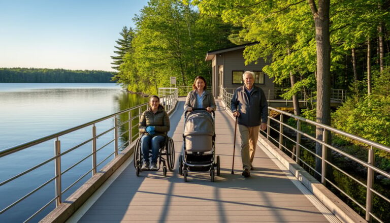
Not everyone can hike rugged backcountry trails or navigate rocky shorelines, but that shouldn’t limit access to Ontario’s breathtaking landscapes. Drone narration opens doors—or rather, skies—for everyone. Whether you’re planning a family trip with young children, traveling with mobility considerations, or simply want to scout a location before committing to the journey, real-time drone feeds let you experience places that might otherwise remain out of reach.
Think about those stunning cliff formations along Georgian Bay that require technical climbing skills, or remote wetlands accessible only by canoe during specific seasons. With drone technology, you can virtually soar above these hidden gems from the comfort of a visitor center or your phone. I’ve watched families with grandparents explore towering waterfalls together through live drone feeds, sharing moments that physical limitations might have prevented.
This technology also proves invaluable during weather closures or seasonal restrictions. When trails flood in spring or ice makes paths treacherous, drones safely capture the beauty you’re missing. It’s not just about convenience—it’s about ensuring everyone can connect with Ontario’s natural wonders, regardless of physical ability or circumstance. That’s genuinely inclusive travel, where technology bridges gaps and creates shared experiences for all.

Where You Can Experience This in Ontario Parks
Right now, Ontario Parks is in the exciting early stages of exploring real-time travel technology, with a handful of forward-thinking parks leading the charge. While we’re not quite at the point where every park offers drone-narrated experiences, the pilot programs underway are genuinely thrilling.
Frontenac Provincial Park, known for its rugged backcountry and extensive hiking trails, has been testing virtual pre-trip orientations that give visitors a bird’s-eye preview of their chosen canoe routes. Imagine being able to virtually paddle down Big Salmon Lake before you even pack your gear – spotting potential campsites, identifying tricky portages, and getting a real sense of distances. Park staff have been using drone footage combined with ranger commentary to help first-time backcountry campers feel more confident about their adventures.
Algonquin Provincial Park has dabbled in educational programs using this technology, particularly for school groups who can’t always make the trip in person. Their virtual tours showcase seasonal changes – how the autumn colours transform the landscape or where wildlife tends to gather during spring. It’s becoming an incredible tool for environmental education, letting students experience the park’s ecosystems in ways that traditional classroom materials simply can’t match.
Killarney Provincial Park has started experimenting with real-time guided experiences for their famous LaCloche Silhouette Trail. Hikers can access pre-recorded drone footage with naturalist commentary that highlights geological features you might otherwise miss, like the stunning white quartzite ridges that make this park so unique.
Here’s an insider tip: contact parks directly before your visit to ask about any virtual orientation sessions they might offer. Many park offices are happy to share drone footage or virtual tours that aren’t yet publicly advertised. It’s a fantastic way to familiarize yourself with trail conditions, especially if you’re planning a challenging backcountry trip.
As this technology becomes more accessible, expect to see expanded offerings across Ontario’s park system. The future of park exploration is literally taking flight, and early adopters are already reaping the benefits of better-prepared, more confident adventures.
The Eco-Friendly Advantage
Here’s something that really excites me about drone narration technology: it’s actually helping protect the places we love to explore. When I first discovered this, I was skeptical about adding more technology to nature experiences, but the environmental benefits changed my mind completely.
Think about those fragile ecosystems in Ontario’s parks – the delicate wetlands, nesting areas, and sensitive habitats that can’t handle heavy foot traffic. Drone narration lets visitors experience these areas virtually without ever setting foot there. I watched a friend explore the remote sections of Algonquin Park through real-time drone feeds while sipping coffee at a safe viewing station. She got incredible views of moose in their natural habitat without disturbing them or trampling the surrounding vegetation. That’s conservation in action.
Park managers are also using this technology brilliantly to spread out visitor crowds. Instead of everyone flocking to the same Instagram-famous viewpoint, drone feeds showcase lesser-known spots that can handle more traffic. This redistribution means popular trails get a breather while underappreciated areas finally get their moment in the spotlight.
Here’s an insider tip: many parks now offer drone-guided educational sessions that explain local conservation efforts while showing you real-time footage of restoration projects or wildlife monitoring. These sessions turn casual visitors into informed advocates.
For responsible use, I suggest choosing parks that use solar-powered drone stations and participating in off-peak hours when wildlife is less active. Support programs that reinvest drone tour fees into habitat protection. And remember, virtual exploration should complement physical visits, not replace them entirely. The goal is experiencing nature more thoughtfully, not avoiding it altogether. When used mindfully, this technology becomes a powerful tool for preserving Ontario’s natural treasures for future generations.
Tips for Getting the Most from Your Virtual Drone Experience
What to Ask Your Live Guide
Your live guide is there to enhance your experience, so don’t be shy about asking questions! Start with practical concerns like “What are the trail conditions like right now?” or “Any muddy sections I should know about?” These real-time updates help you pack appropriate footwear and gear.
Wildlife enthusiasts should ask “Have you spotted any animals today?” or “What’s been active this week?” Guides often know which beaver dams are bustling or where moose have been grazing lately. For camping trips, try “What’s special about this campsite?” to discover hidden perks like secluded swimming spots or perfect sunrise views.
Weather questions are always smart: “Is that system moving in fast?” helps with timing decisions. And here’s an insider tip – ask about seasonal highlights! “What’s blooming right now?” or “When do the loons typically arrive?” reveals nature’s calendar. Your guide’s local knowledge transforms good adventures into unforgettable ones, giving you insider access to the park’s rhythms that no app can match.
How to Translate Virtual Scouting into Real Adventure
Think of your drone preview as the ultimate trail cheat sheet. I recently watched a 360-degree tour of Arrowhead Provincial Park’s Stubbs Falls trail and noticed the rocky sections where I’d need sturdy boots instead of sneakers. The drone footage revealed sun exposure levels too, helping me pack extra sunscreen and plan for a morning start.
Take screenshots of key landmarks during your virtual tour—they become your real-world navigation aids. Notice what hikers in the footage are wearing to gauge appropriate layers. Those overhead views also reveal parking lot sizes, so you’ll know whether arriving by 9 AM is essential or if you can sleep in.
Here’s my insider tip: pause the video when the narrator mentions seasonal highlights. If they’re showing autumn colours or spring wildflowers, note those timeframes for booking your actual visit. Pair this knowledge with smart outdoor technology like GPS apps, and you’ll hit the trail feeling like a local rather than a tourist fumbling with paper maps.
What’s Next: The Future of Interactive Park Exploration
The horizon for virtual park exploration is brightening with possibilities that’ll transform how we connect with Ontario’s wilderness. Imagine strapping on AR goggles before your hike and seeing Indigenous place names floating above landmarks, or watching a digital beaver explain dam-building techniques right where you’re standing. These AR storytelling experiences are already in development, blending the digital and natural worlds seamlessly.
Parks Ontario is exploring personalized virtual tours where an AI ranger learns your interests—maybe you’re fascinated by geology or bird migration—and tailors live drone commentary accordingly. Even more exciting? Group virtual campfire sessions where rangers connect with multiple viewers simultaneously, answering questions in real-time while sharing wildlife footage captured that very day.
Here’s the insider perspective: this technology isn’t meant to keep you on your couch. Think of it as your enthusiastic friend who scouts ahead, helps you plan smarter trips, and deepens your appreciation before boots hit the trail. It’s the ultimate eco-friendly trip planner—reducing unnecessary drives while building genuine excitement for the real thing.
Here’s the truth: real-time drone narration isn’t meant to replace the feeling of pine needles crunching beneath your boots or the thrill of spotting a great blue heron at dawn. Think of it as your tech-savvy trail companion, the one who’s scouted ahead and wants to share the best route with you. This technology bridges the gap between dreaming about an adventure and actually living it, giving you the confidence to explore parks you might have otherwise overlooked.
The beauty lies in how these drone experiences inform your planning without dictating it. You get to see current trail conditions, weather patterns, and crowd levels before you pack the car. Maybe that bird’s-eye view reveals a quieter lakeside spot perfect for your family picnic, or shows you that the autumn colours have peaked a week earlier than expected. You’re making smarter decisions, not sacrificing spontaneity.
We’d love to hear your stories! Have real-time drone views helped you discover a hidden corner of Algonquin? Did they convince you to visit a park during an unexpected season? Share your experiences and let’s build a community that celebrates how thoughtful technology can deepen our connection to Ontario’s incredible natural spaces.


+ There are no comments
Add yours